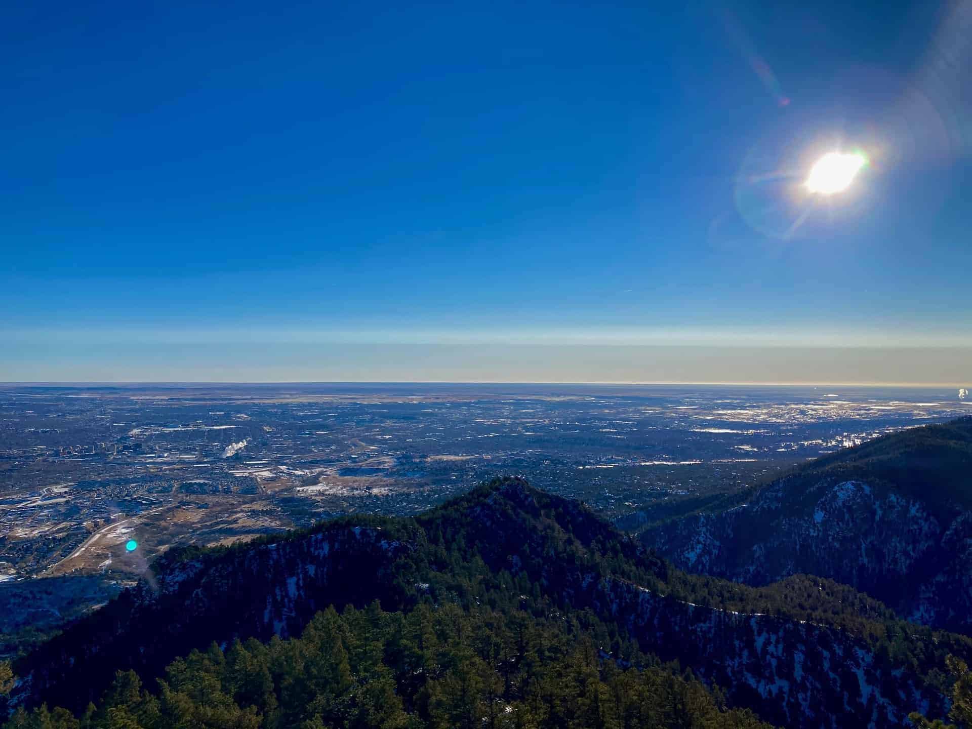
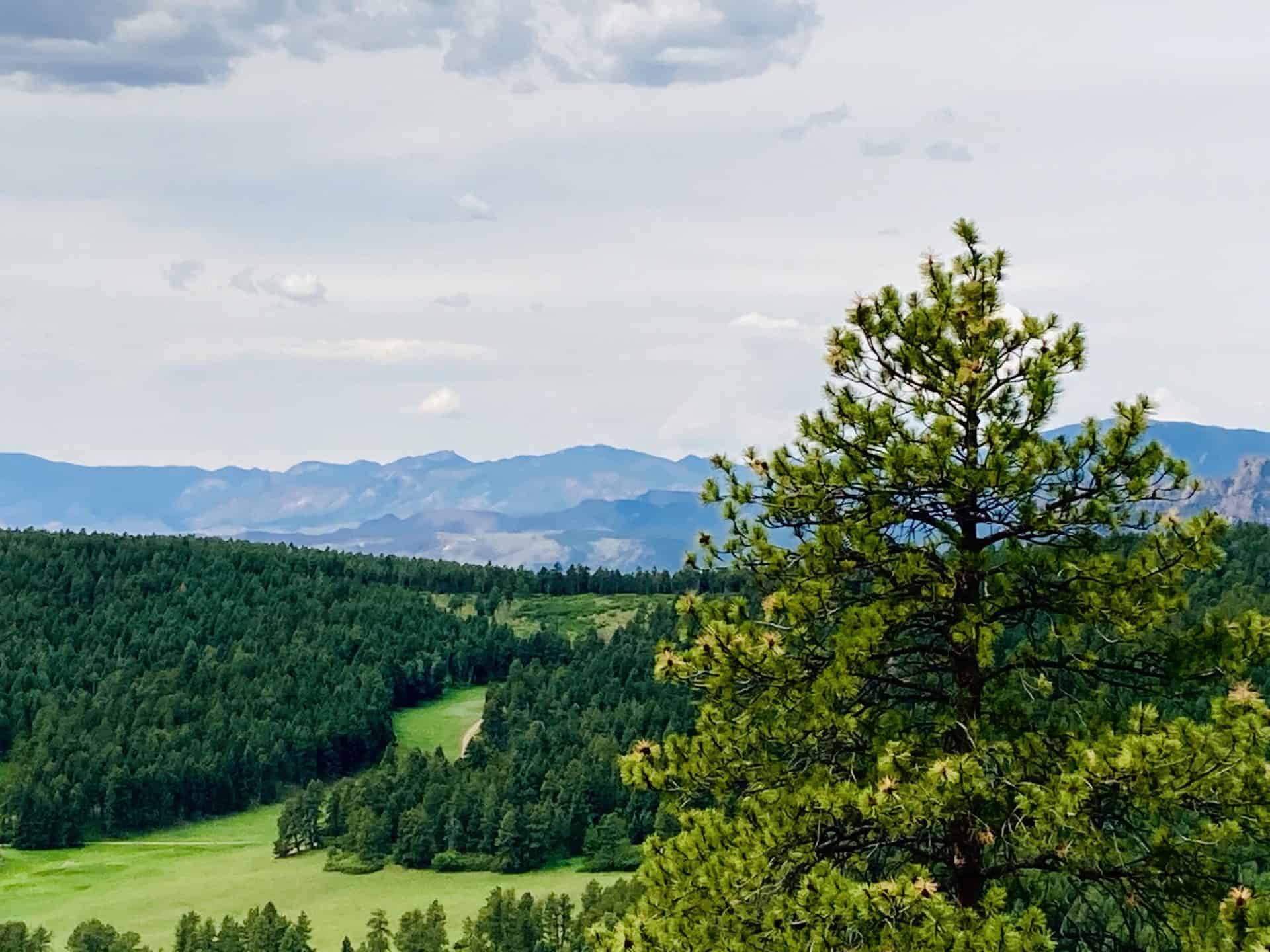
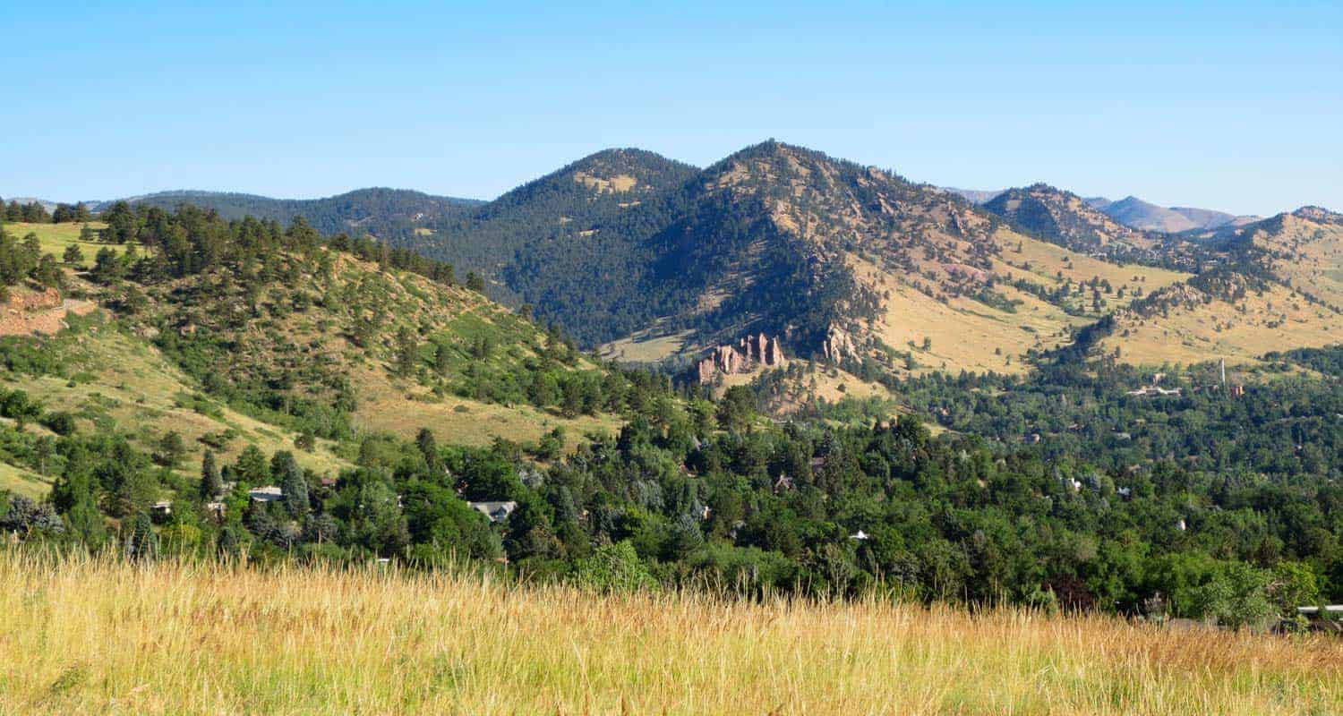
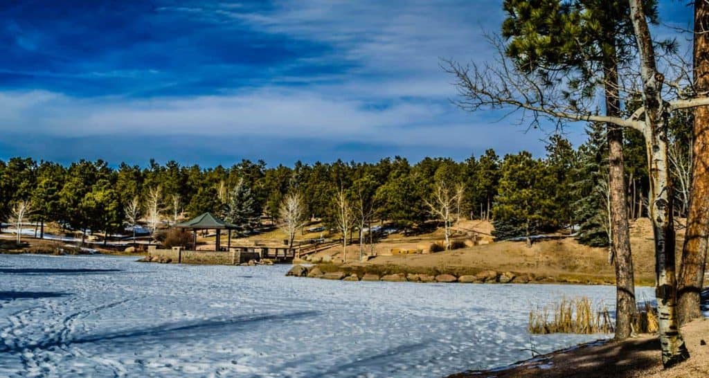
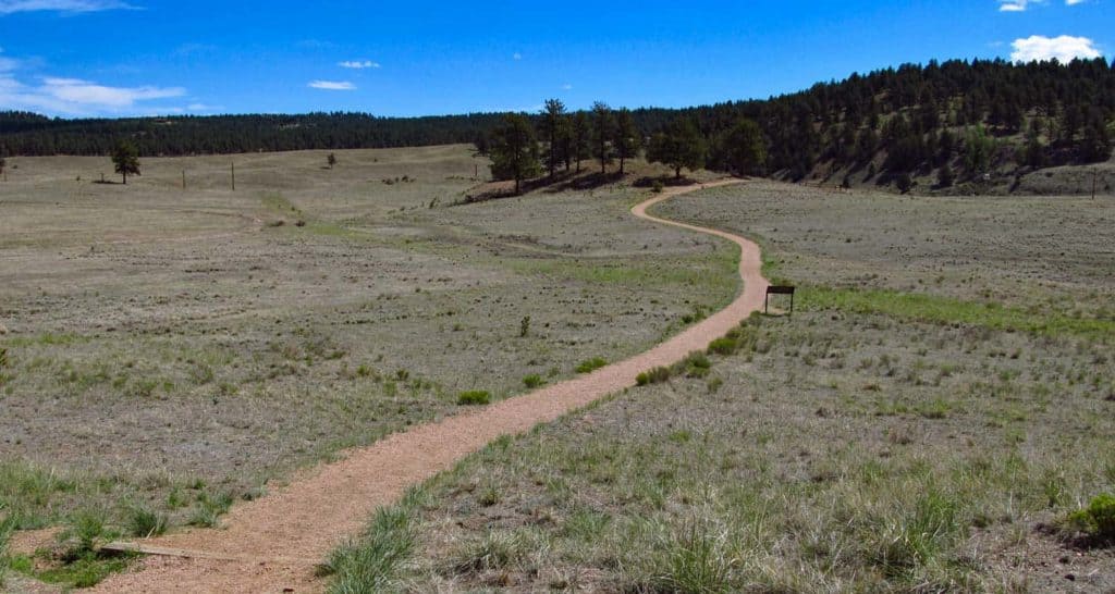
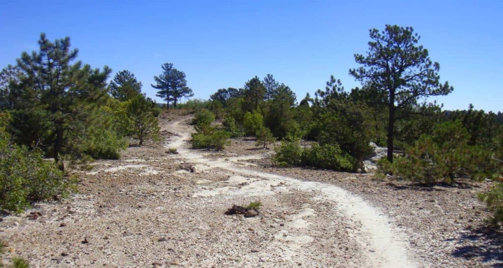
Mt. Buckhorn hike near Colorado Springs
The Mt. Buckhorn Hike, taking the shape of what hikers often call a "lollipop loop," forms the bridge between the Section 16 hike and the Seven Bridges & Kineo Mountain hike.
As with those hikes, the surprising aspect is its immediacy -- within minutes of turning off the highway the trailhead appears. And if parking has filled, other options await in the vicinity. Explore the full Mt. Buckhorn Hike profile below for trail map, driving directions, and more tips and details to help you enjoy this year-round adventure just south of Denver.
Trail Snapshot: Mt. Buckhorn Lollipop Loop
| Hike Distance | 6.25 miles Round Trip |
|---|---|
| Difficulty | Moderate to Difficult |
| Duration | Approx 3-4hr |
| Trail Type | Loop |
| Starting Elevation | 6,600′ |
| Elevation Gain | Approx +1,600′ |
| Seasons | Year Round |
| Dogs | Allowed On Leash |
| Hike Trail Map | Click for Trail Map of the Mt. Buckhorn Hike |
| Denver Drive Time | 1.25 hours |
| Driving Directions to Mt. Buckhorn Trailhead | Click for Google Map |
| Town Nearest Hike | Manitou Springs and Colorado Springs, Colorado |
| Beauty | backcountry valleys, views of Colorado Springs |
| Activities | Hiking, Biking, Snowshoeing |
Parking & Trailhead Information for Section 16 Trail
From Denver, cruising south on I-25, take exit 141 for Highway 24 West. After approximately 1.5 miles, turn left (south) onto 21st Street, and then shortly thereafter, right (west) onto Lower Gold Camp Road. Turning left at the 4-way stop (junction with Bear Creek Road), the Bear Creek Canyon pullout parking trailhead appears on the left just prior to the 3-way junction with a bend of Gold Camp Road. This parking lot offers head-in spots and fills fast; other pullout parking lots dot the road before and after this one.
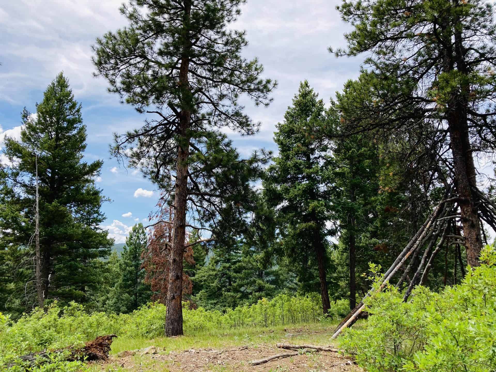
The Hike: Mt. Buckhorn Lollipop Loop Hike
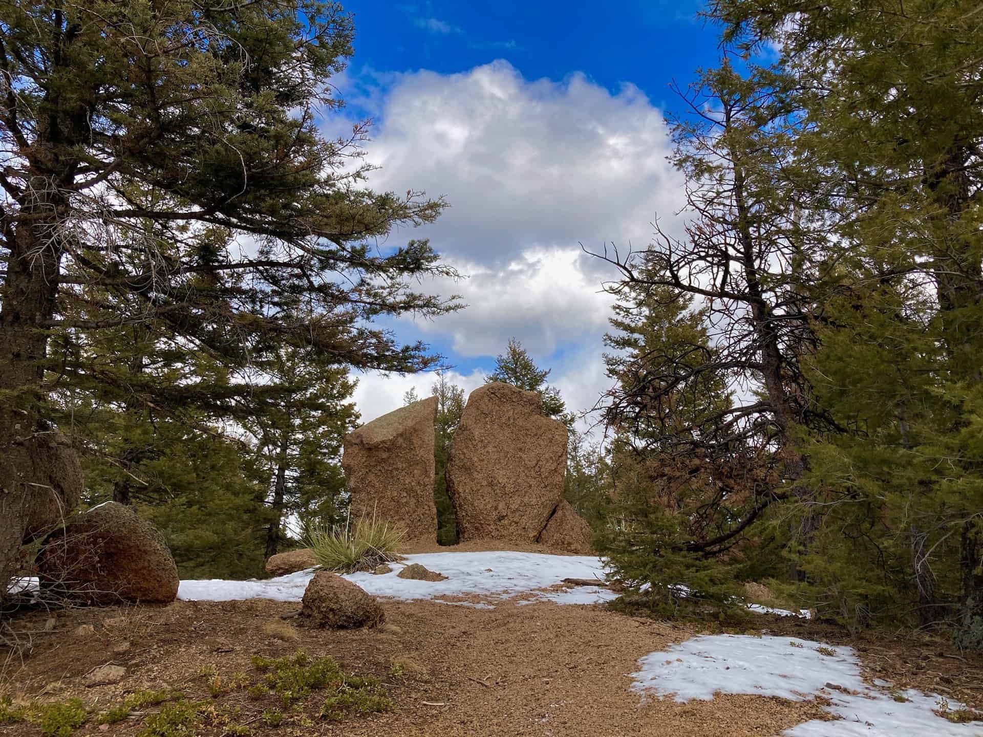
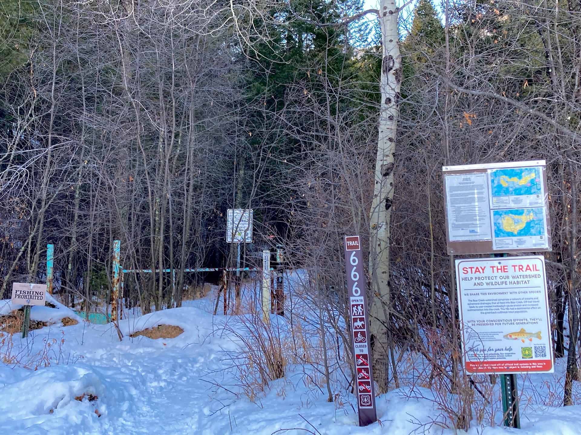
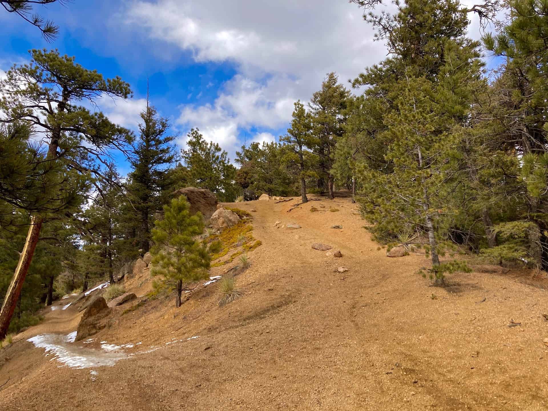
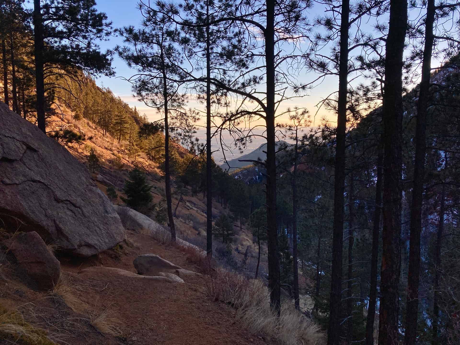
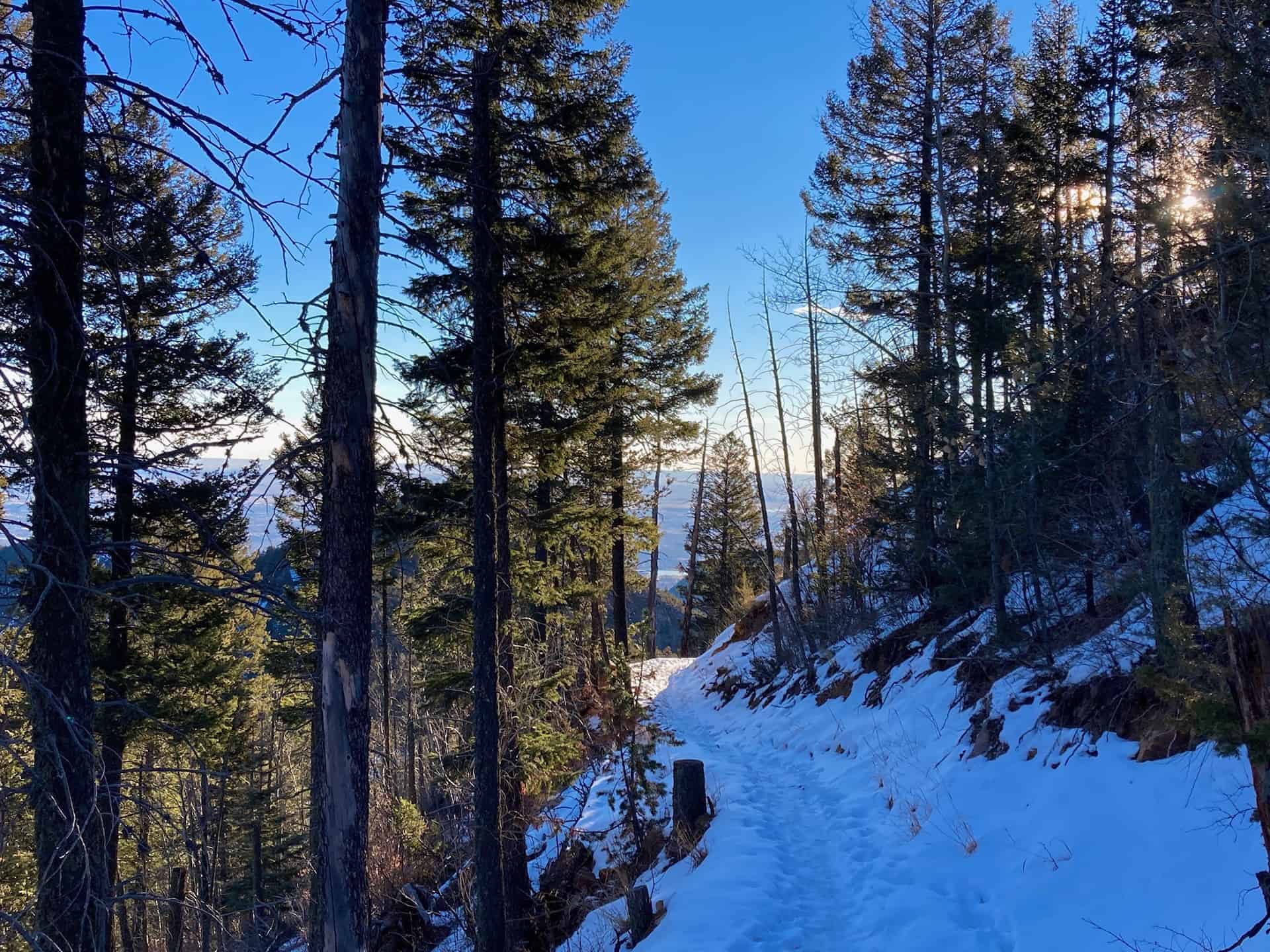
Leaving the parking lot, continuing toward the junction with Gold Camp Road, the route joins High Drive. High Drive meanders up into the backcountry past split-rail fences, over rock bridges, and through wide slot canyons. At approximately the 1-mile mark, less than 1/4-mile past the Section 16 Hike trail junction, the junction for the ominously named Trail 666 branches off to the right.
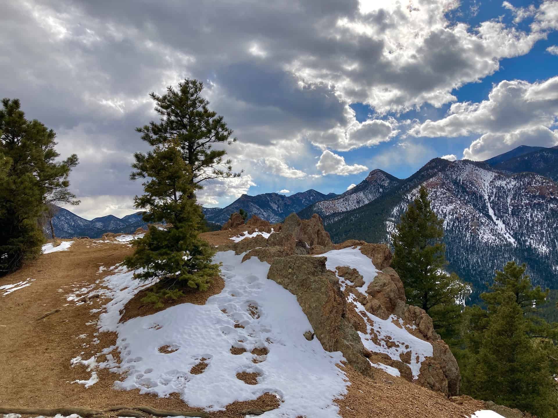
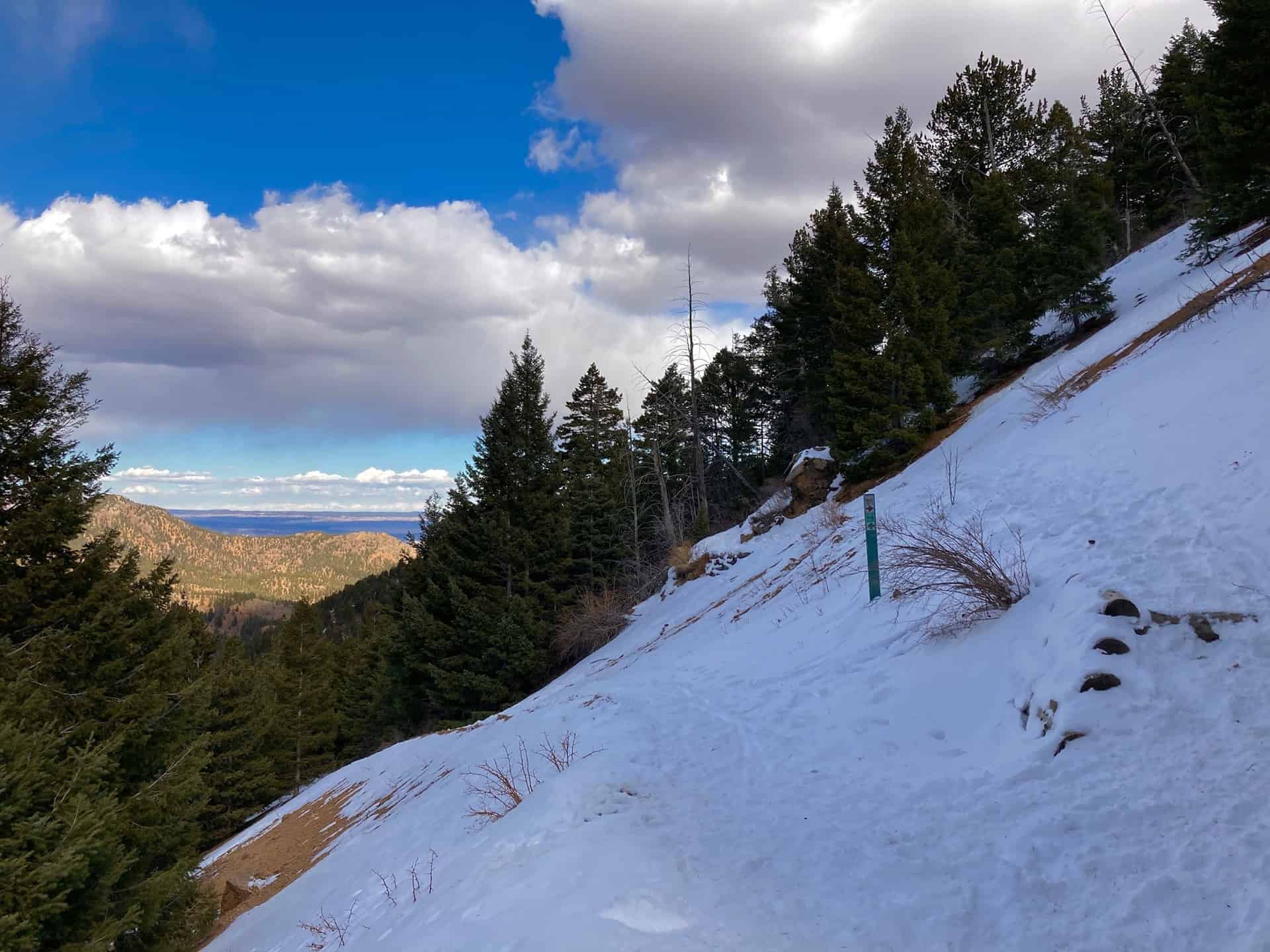
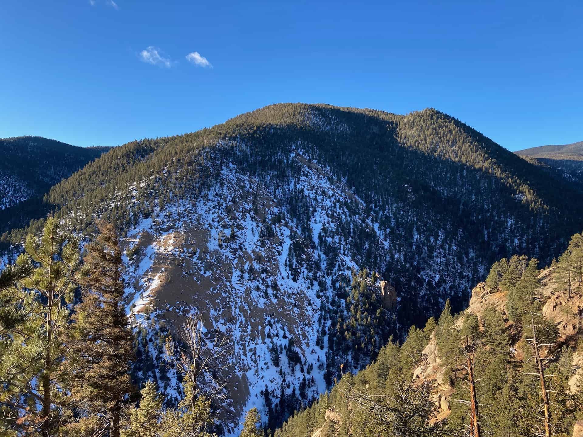
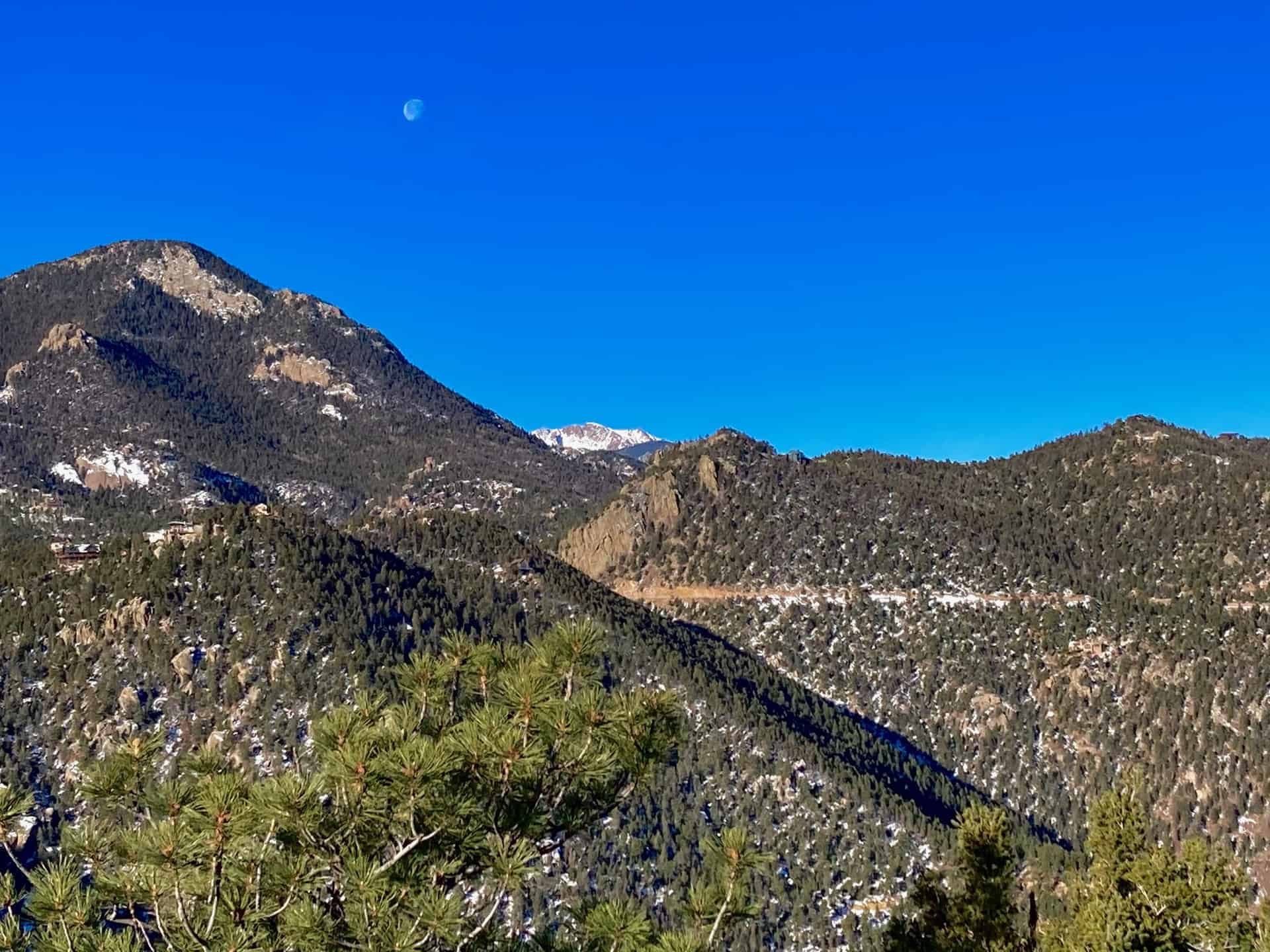
Over the next 1.5 miles, Trail 666 traces the valley wall, gracing hikers with unobstructed views of the basin below, crags on the opposite valley wall, and view of Colorado Springs in the rearview mirror. After ascending nearly 1,000ft, the route meets the junction with Trail 776. Taking a sharp left, Trail 776 tugs toward a 180-degree turn up the valley slope.
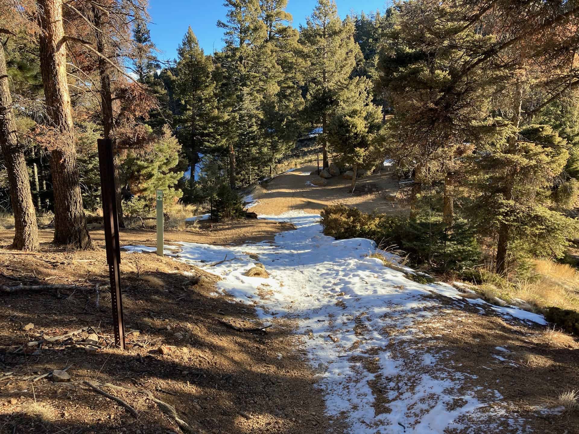
Now as the trail levels, more vistas break open to hikers' delight. Approximately 1/2-mile up the trail, another key junction helps guide the backcountry adventurer. Trail 776 (aka Buckhorn Trail) crosses paths with Trail 667 (Upper Captain Jack's Trail). Here one finds the connecting point to the Seven Bridges & Kineo Mountain hike. Staying slightly left by joining Trail 667, the route moves further into the backcountry and a stunning new valley. At the end of the elevation shelf, approximately 1/3-mile ahead, those with energy and gumption can trek to the top of Mt. Buckhorn. This adds about 1/2-mile total to the hike.
Continuing along Trail 667, the route begins its steady descent to meet up again with High Drive, but at a different juncture. At High Drive, a broad open space with signage and fencing, the lollipop loop turns left down the wide High Drive road and rolls 1.5-miles back to where Trail 666 first appeared. (Note carefully that Trail 667 (Captain Jack's) crosses over High Drive and resumes climbing up the facing ridge. Taking the trail, instead of High Drive, will pull hikers far into the backcountry and away from the originating parking pullout.)
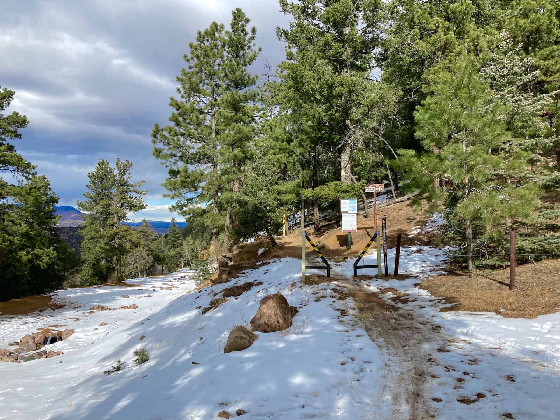
The last part of the Mt. Buckhorn lollipop loop hike simply follows High Drive all the way. Generally staying straight, with a couple hard curves along the way, the trail flows back down and out approximately 2.5 miles to the parking pullout.
Tips & Resources for Hiking Mt. Buckhorn near Colorado Springs
- TIP: Parking fills fast, but an early start helps noticeably.
- Trail Map: Mt. Buckhorn Hike
- Packing List: Always pack the 10 Essentials. Download our Hiking Guide to get the list and dayhiking packing checklist. Additionally, take some time to review our 10 Winter Hiking Tips.
- Colorado Road Conditions: Colorado Road Conditions
- After the Hike: A local favorite, Wild Goose Meeting House (or their counterpart, Good Neighbors Meeting House), captures the essence of downtown COS. Grab a craft coffee and chef-level dish, or later in the day, a local beer on tap. For a quick grab-n-go, consider Wimberger's Old World Bakery and Delicatessen, on the way out from the trailhead.
Weather
Map & Driving Directions
Click for Driving Directions
Seven Bridges to Kineo Mountain Loop
Immensely popular in the summer, the Seven Bridges trail beckons hikers up and across North Cheyenne Creek multiple times, meandering by and over tumbling creek waterfalls. The route described below launches from the Seven Bridges trail out onto a loop around Kineo Mountain, reaching a connection point with the Mt. Buckhorn hike. These two loops, along with the Section 16 hike, create opportunity for a longer figure-8 adventure, or even a double-helix hike for those wanting an all-day excursion.
Due to its easily accessible trailhead, crowds are common -- those wanting a simpler, quieter experience aim for an early morning start or a winter hike. Depending on recent weather in winter months, traction may be required, but the frozen waterfalls, snow-laden evergreens, and shimmering valley views make it worth it. Explore the full Seven Bridges to Kineo Mountain Hike profile below for trail map, driving directions, and more tips and details to help you enjoy this year-round adventure just south of Denver.
Trail Snapshot: Seven Bridges to Kineo Mountain Loop
| Hike Distance | 7.5 miles Round Trip |
|---|---|
| Difficulty | Moderate to Difficult |
| Duration | Approx 4hr |
| Trail Type | Loop |
| Starting Elevation | 7,500′ |
| Elevation Gain | Approx +1,600′ |
| Seasons | Year Round |
| Dogs | Allowed On Leash |
| Hike Trail Map | Click for Trail Map of the Seven Bridges to Kineo Mountain Hike |
| Denver Drive Time | 90 minutes |
| Driving Directions to Seven Bridges Trailhead | Click for Google Map |
| Town Nearest Hike | Manitou Springs and Colorado Springs, Colorado |
| Beauty | waterfalls, backcountry valleys, views of Colorado Springs |
| Activities | Hiking, Biking, Snowshoeing |
Parking & Trailhead Information for Seven Bridges Trail
From Denver, cruising south on I-25, take exit 140 for Tejon Street. After turning right onto Tejon, curve slightly right through the traffic circle to jump onto Cheyenne Blvd. In 2.5 miles, stay right and begin the ascent up North Cheyenne Canyon Road. About 3 miles up the road a large dirt parking lot sits at the junction of Cheyenne Canyon Road, Gold Camp Road, and High Drive (gated). (Note: just prior to reaching this junction, daytime sightseers can stop at Helen Hunt Falls.) The Seven Bridges parking lot fills fast and sometimes attracts unscrupulous thieves, so we recommend going early and placing valuables securely out of sight.
The Hike: Seven Bridges to Kineo Mountain Loop
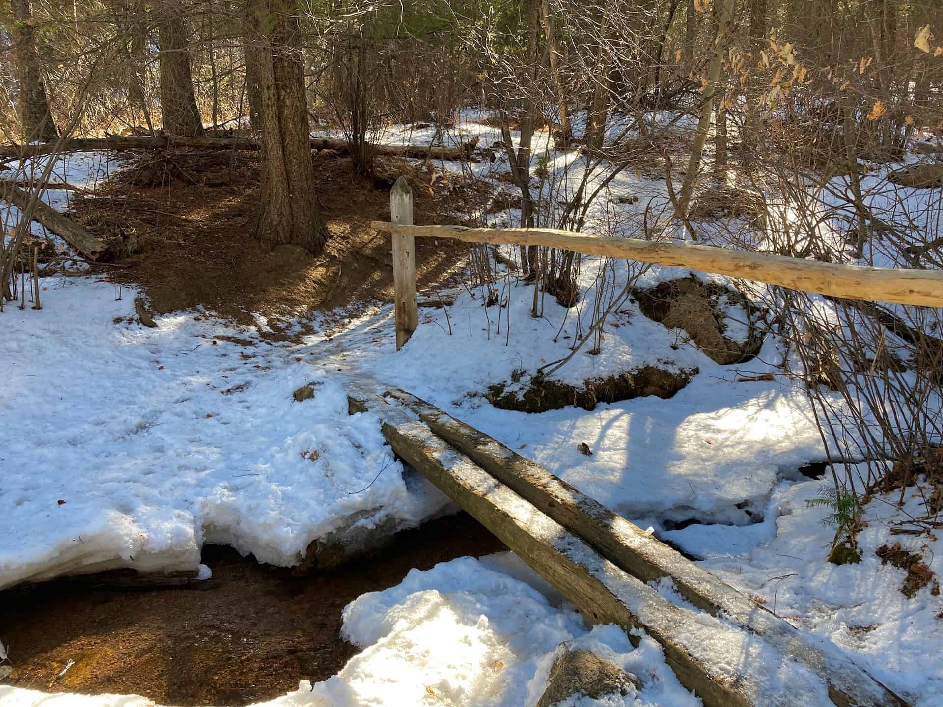
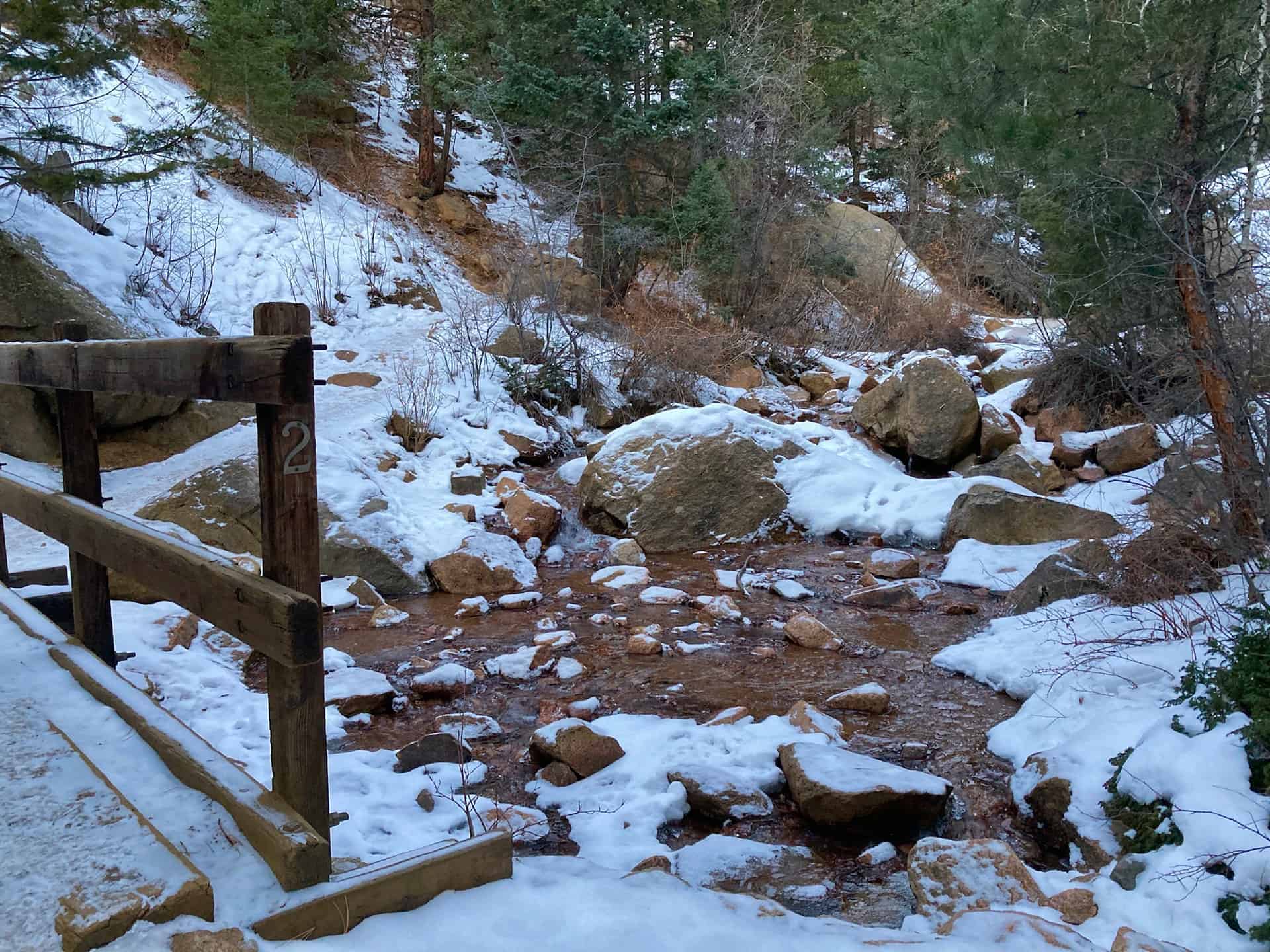
The trail commences at the far end of the parking lot, beyond a stout gate, heading up the decommissioned section of Gold Camp Road. At about 3/4-mile, the road crosses North Cheyenne Creek and immediately after, on the left, appears the Seven Bridges Trail (#662) junction.
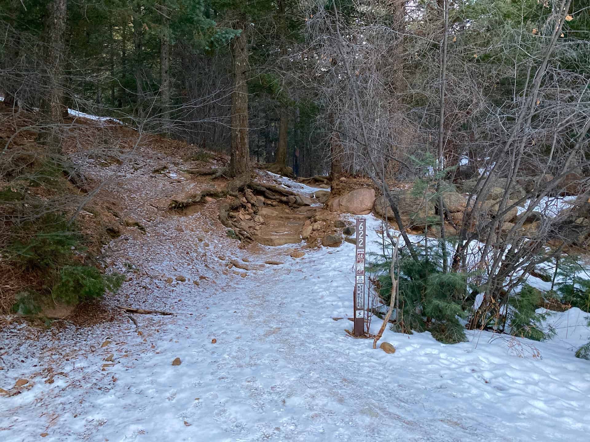
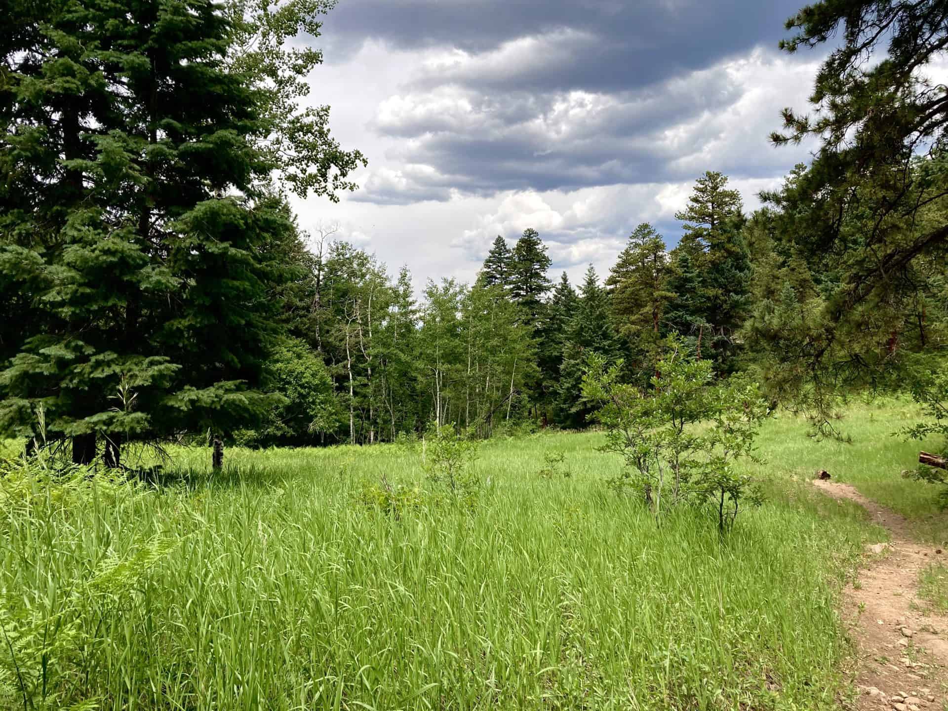
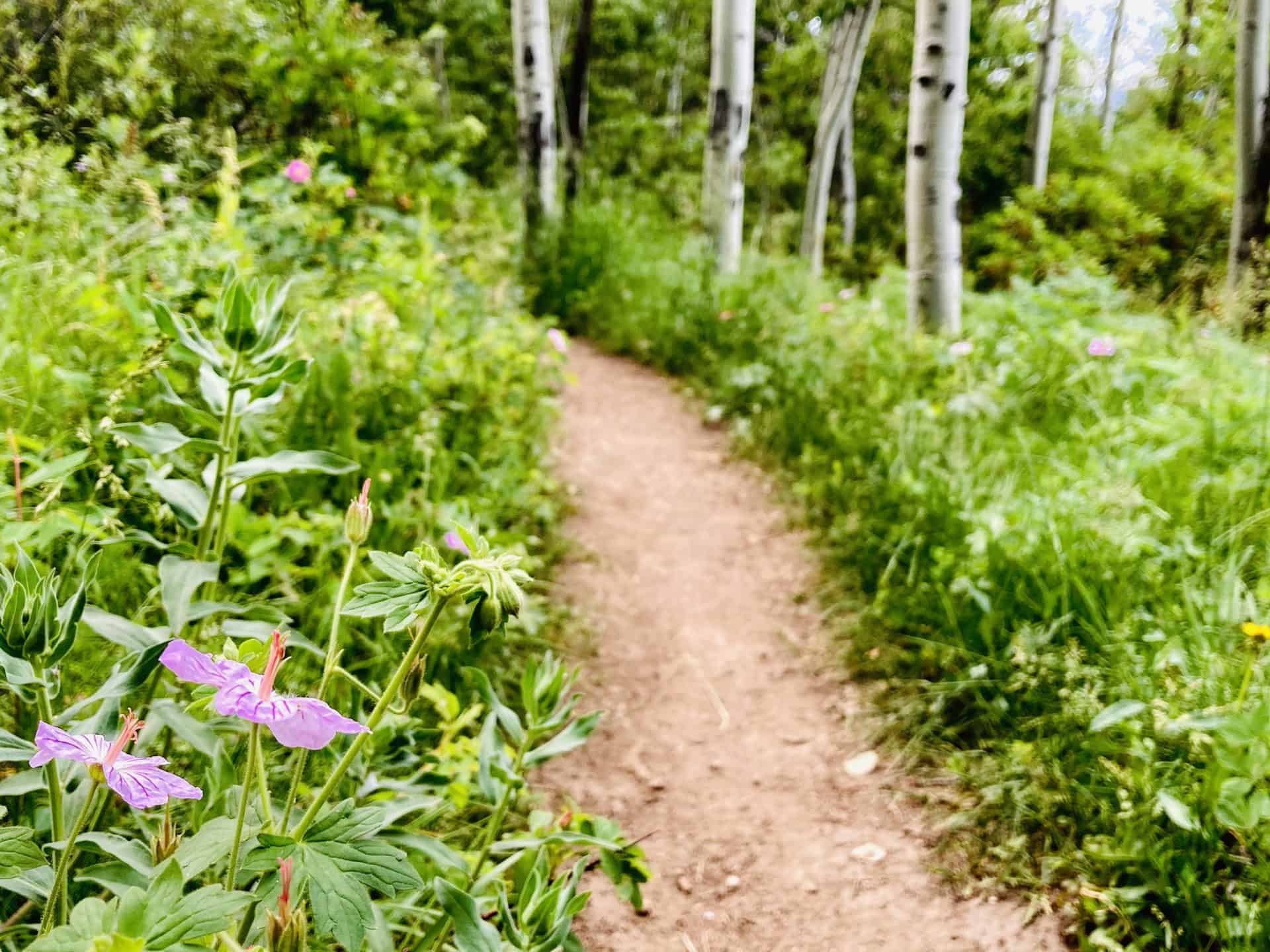
Over the next 1/4-mile, Trail 662 follows the creek, crossing it seven times. This short stint offers nearly endless opportunities to stop, listen, marvel and wonder. After Bridge #7, the trail steepens considerably as it stretches toward its junction with the overlapping Jones Park (#701) / Kineo Mountain / Captain Jack's (#667) trails. Just under 1.5 miles ahead, a bypass trail curves off to the right, marked by bright fuchsia blazes. Taking this bypass reduces the total hike lengthy by approximately 3/4-mile. If staying straight to reach the multi-trail junction, continue for another 1/4-mile along the creek and then turn sharply right onto Trail 701/667. The route levels and lingers along the backcountry ridge through evergreen and aspens, providing respite from the steady ascent.
Now the joyful task is simply plodding along a valley ridge for about 2.5 miles, up to the connection with the Mt. Buckhorn hike trail. The route weaves in and out of trees, punctuating the hike with vistas of the trail hiked 2.5 miles ago, etched into the opposite valley wall.
After the junction with Bear Creek Trail (#666), the Kineo Mountain loop continues by swinging back right, down the slope onto Trail 776 (Buckhorn Trail). Following this for about 1 mile, another bypass greets hikers on the left, permitting them to quickly regain Gold Camp Road and stroll back to the parking lot.
Tips & Resources for Hiking the Seven Bridges to Kineo Mountain Loop
- TIP: Parking fills fast, but an early start helps noticeably. Once back to the vehicle after the hike, a drive down Gold Camp Road cruises through chiseled tunnels and by more trailheads, used by hikers and bikers alike. Please note: this stretch of road is maintained but not paved and has several narrow turns. Do not drive this return route unless accustomed to mountain driving.
- Trail Map: Seven Bridges to Kineo Mountain Hike
- Packing List: Always pack the 10 Essentials. Download our Hiking Guide to get the list and dayhiking packing checklist. Additionally, take some time to review our 10 Winter Hiking Tips.
- Colorado Road Conditions: Colorado Road Conditions
- After the Hike: A local favorite, Wild Goose Meeting House (or their counterpart, Good Neighbors Meeting House), captures the essence of downtown COS. Grab a craft coffee and chef-level dish, or later in the day, a local beer on tap. For unique local fare, consider Edelweiss, a Old World treat.
Weather
Map & Driving Directions
Click for Driving Directions
Section 16 Hike near Manitou Springs
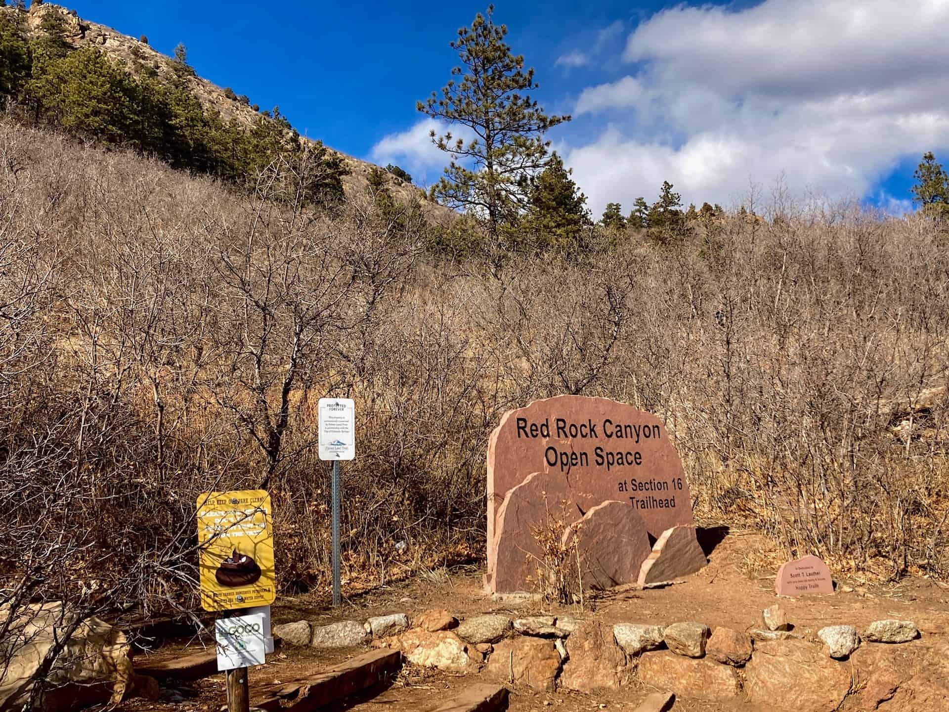
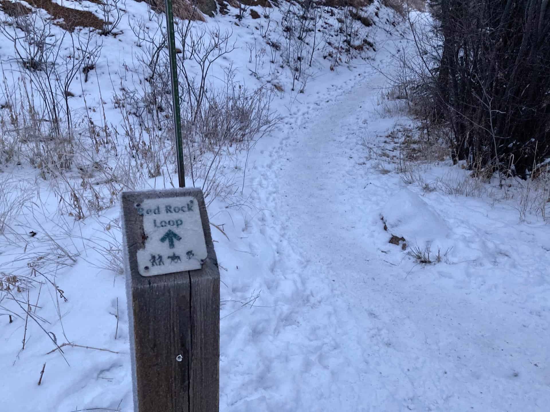
Nestled between Manitou Springs on the west and Colorado Springs on the east, the Manitou Section 16 Open Space overlaps with the Red Rock Canyon Open Space to the north, just off Highway 24. Both of these systems connect to two other regional parks, creating a massive complex of trails that delights hikers of all ages and abilities. This route follows three trails through two territories for one heckuva hike! For the eager, this route can be augmented with the Mt. Buckhorn hike, and even the Seven Bridges & Kineo Mountain hike for the all-day trekker.
The surprising aspect of this Section 16 hike is its immediacy -- within minutes of turning off the highway the trailhead appears. Within minutes of leaving the trailhead the cityscape disappears. Even better, this hike delights hikers in all seasons: the new growth of spring, the full blossom of summer, the changing colors of fall, and the magically reflective light of winter's snow. Explore the full Section 16 Hike profile below for trail map, driving directions, and more tips and details to help you enjoy this year-round adventure just south of Denver.
Trail Snapshot: Section 16 Trail
| Hike Distance | 5.5-6.25 miles Round Trip |
|---|---|
| Difficulty | Moderate |
| Duration | Approx 3-4hr |
| Trail Type | Loop |
| Starting Elevation | 6,600′ |
| Elevation Gain | Approx +1,300′ |
| Seasons | Year Round |
| Dogs | Allowed On Leash |
| Hike Trail Map | Click for Trail Map of Section 16 Hike |
| Denver Drive Time | 1.25 hours |
| Driving Directions to Section 16 Trailhead (Section 16) | Click for Google Map |
| Town Nearest Hike | Manitou Springs and Colorado Springs, Colorado |
| Beauty | Pike's Peak, views of Colorado Springs |
| Activities | Hiking, Biking, Snowshoeing |
Parking & Trailhead Information for Section 16 Trail
From Denver, cruising south on I-25, take exit 141 for Highway 24 West. After approximately 1.5 miles, turn left (south) onto 21st Street, and then shortly thereafter, right (west) onto Lower Gold Camp Road. Staying straight through the 4-way stop (junction with Bear Creek Road), the Palmer Red Rock (Section 16 Open Space) trailhead is just under one mile up on the right. This parking lot offers about a dozen head-in spots and fills fast; another pullout parking lot is available up the road on the left.
The Hike: Section 16 Trail in Red Rock Canyon Open Space
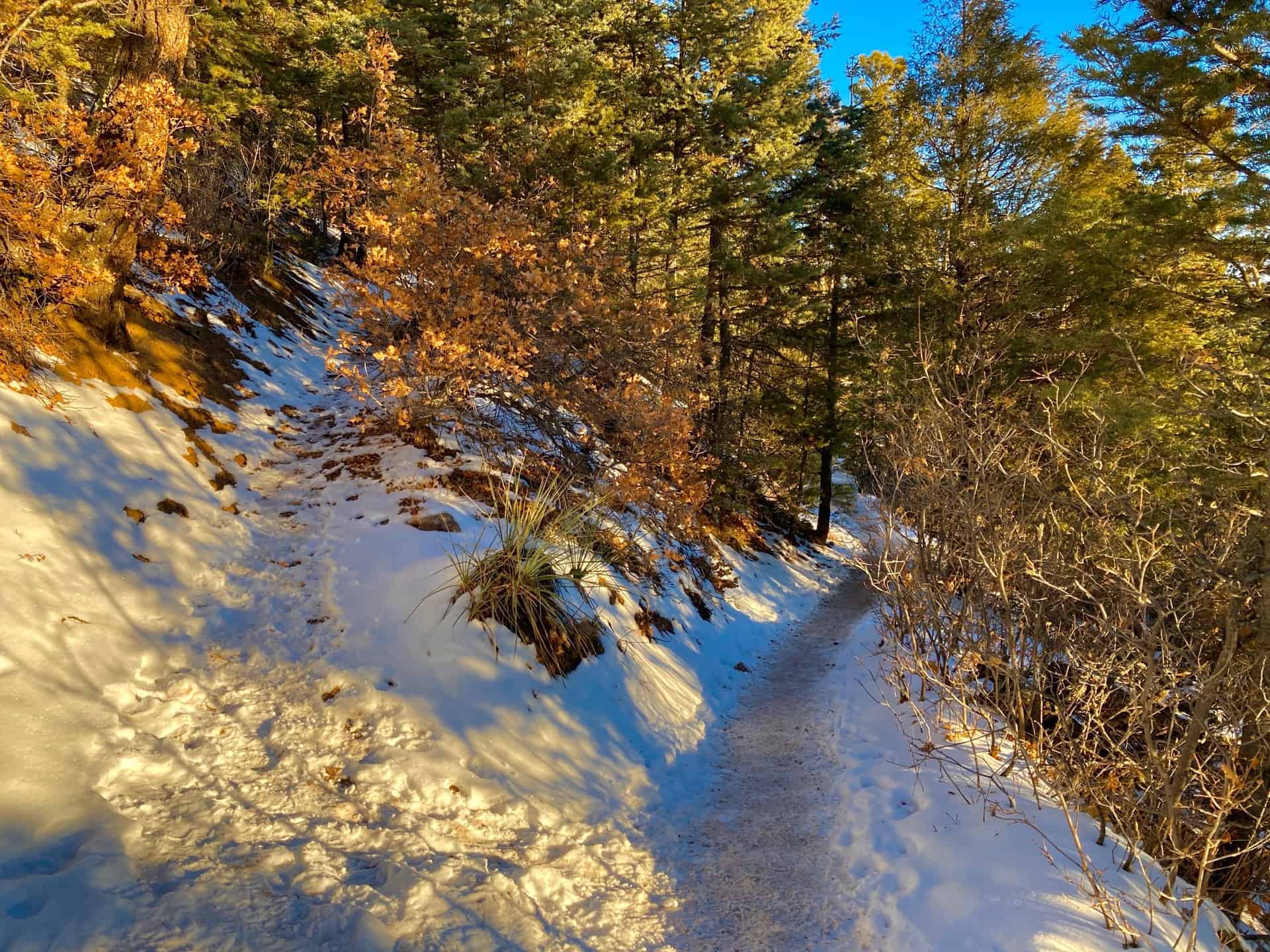
While many hikers jump straight into the trek by ascending the stairs at the trailhead, taking a counter-clockwise tack, the following notes describe a clockwise path. This direction provides a spectacular viewing angle on Pike's Peak, and positions hikers for a fun descent through the trees at the end.
Leaving the parking lot, continuing up Gold Camp Road (which actually heads southwest), the route joins High Drive after 1/4-mile just as the road turns sharply left. High Drive meanders up into the backcountry past split-rail fences, over rock bridges, and through wide slot canyons. At approximately the 1-mile mark, the junction for the Section 16 Trail branches off to the right.
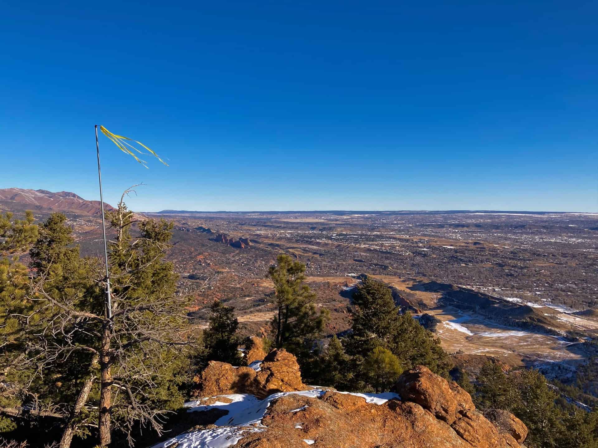
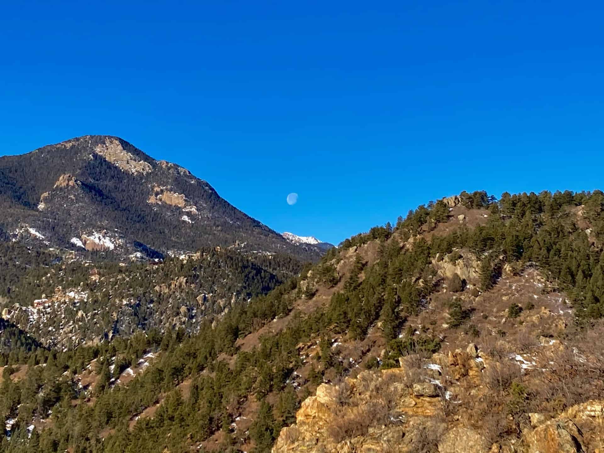
Now on Section 16 trail officially, the trail weaves in and out of forest, gently ascending toward a top elevation of nearly 7,900ft. At this point, around the 3.5 miles, watch for a connector trail shooting off to the left. For the curious, a short jaunt out and back affords sweeping views of peaks around Manitou Springs, as well as Garden of the Gods outside Colorado Springs.
Staying right and beginning a descent, the Section 16 Trail continues another 3/4-mile to an excellent excursion on an unmarked overlook trail. The tributary is heavily trafficked and easy to identify: it runs straight out from the main trail just prior to a moderate lefthand descent deep into the forest and rounds of switchbacks. The overlook ridge out-and-back adds approximately 3/4-mile to the overall milage of this loop. Once at the ridge edge, the sprawling plains of Colorado Springs spread out like a carpet from the forest's edge. Turning back toward the main trail, hikers gaze on Pike's Peak, perched between two converging foothill peaks.
The last part of the Section 16 Hike loop presents hikers with multiple connector trails. Generally staying straight, the trail flows back down and out of the valley approximately 2.25 miles to the parking lot.
Tips & Resources for Hiking Section 16 in the Red Rock Canyon Open Space
- TIP: The two connecting open space trail systems remain popular all year long. Parking fills fast, but an early start helps noticeably. Also, consider carrying a complete map that displays the many connector trails, such as this Red Rock Canyon Open Space Trail Map.
- Trail Map: Section 16 Hike
- Packing List: Always pack the 10 Essentials. Download our Hiking Guide to get the list and dayhiking packing checklist. Additionally, take some time to review our 10 Winter Hiking Tips.
- Colorado Road Conditions: Colorado Road Conditions
- After the Hike: A local favorite, Wild Goose Meeting House (or their counterpart, Good Neighbors Meeting House), captures the essence of downtown COS. Grab a craft coffee and chef-level dish, or later in the day, a local beer on tap. For a quick grab-n-go, consider Wimberger's Old World Bakery and Delicatessen, on the way out from the trailhead.
Weather
Map & Driving Directions
Click for Driving Directions
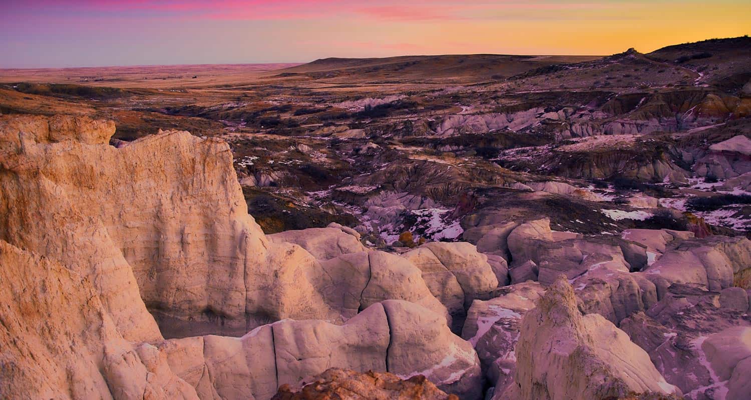
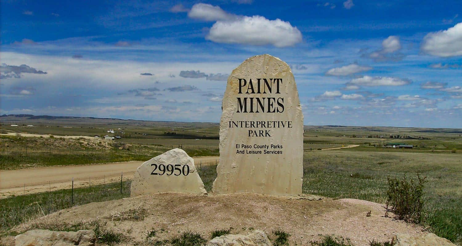
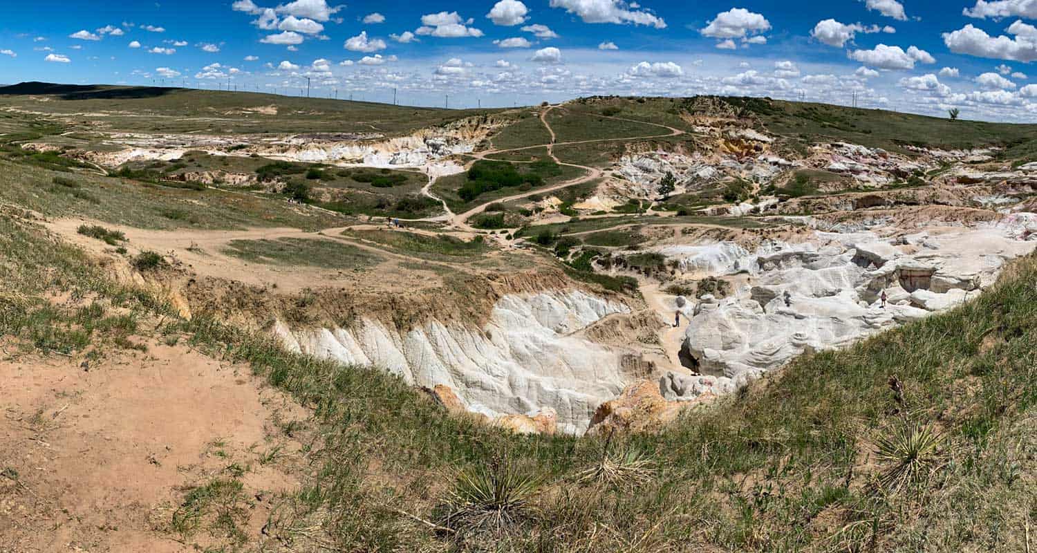
Paint Mines Hike Near Colorado Springs
The Paint Mines trail takes hikers on an easy 3.7 mile loop through a badlands landscape of rainbow sandstone and hoodoo rock formations about 90 minutes south of Denver and 45 minutes east of Colorado Springs. Explore the full Paint Mines hike profile below for trail map, driving directions, and more tips and details to help you enjoy this adventure in the plains of Colorado.
Trail Snapshot: Paint Mines Loop
| Hike Distance | 3.7 miles Round Trip |
|---|---|
| Difficulty | Easy |
| Duration | Approx 2 Hours |
| Trail Type | Loop |
| Starting Elevation | 6600′ |
| Elevation Gain | Approx +200′ |
| Seasons | Year Round |
| Dogs | Dogs are prohibited at the Paint Mines |
| Hike Trail Map | Click for Trail Map of the Calhan Paint Mines |
| Denver Drive Time | 1hr 40min |
| Driving Directions to Paint Mines Interpretive Park | Click for Google Map |
| Town Nearest Hike | Calhan, Colorado |
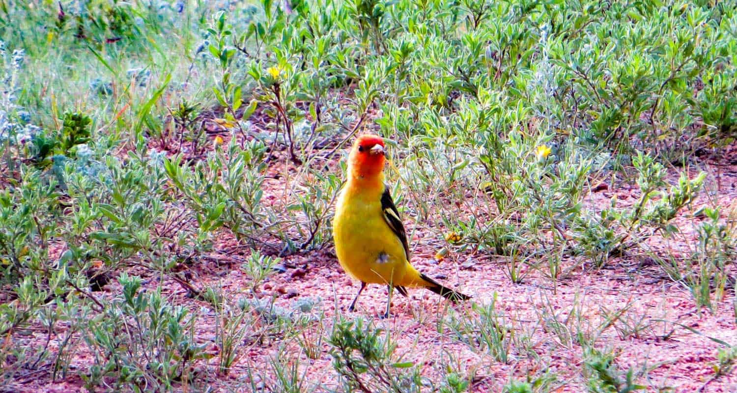
| Beauty | Rock Formations, Views of Pikes Peak, native Buffalo Grass, Lark Bunting, pronghorn antelope, and horned lizards. |
| Activities | Hiking (bikes are prohibited), Picnic Tables, Interpretive Displays |
Driving Directions to the Paint Mines
From Denver, take interstate 25 south toward Colorado Springs. Exiting at exit 163, take a left (east) onto South County Line/Palmer Divide Road, traveling for about 5 miles before then taking a right onto CO-83. Travel for about 4 miles, then turn left onto Hodgen Road.Travel for 10.3 miles on Hodgen Road, then take a right onto Eastonville Road. Going for about 2 miles, turn left onto Murphy Road (a lot of turns on this drive). Go 5 miles on Murphy Road, then take a right onto Peyton Hwy. Travel for about 1 mile, then just before you get into the small town of Peyton, take a left to stay onto Peyton Hwy. This segment is just about 0.2 of a mile before you turn left onto Highway 24 which will take you into the town of Calhan. Driving through town and take a right onto Yoder St./North Calhan Hwy (south). Just past the El Paso County Raceway, take a left onto Paint Mine Road. After 1.4 mile on Paint Mine Road, the trailhead and parking area will be on your left.
Parking & Trailhead Information for the Paint Mines
The parking area for the Paint Mines has spaces for about 40 vehicles. Though the park is hidden away in the plains of Colorado, it's a well-known park and the lot can fill up on weekends. There is a toilet facility at the trailhead parking area. No water, so bring water with you.
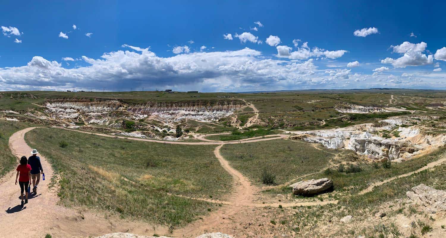
The Hike: Paint Mines Loop
We recommend hiking this trail clockwise. There is a northern and southern trailhead (and a West overlook lot), and the route described here begins at the larger, northern trailhead (described above). The trail begins near the restroom on the southeast side of the parking area and travels northeast into a grasslands lanscape. The path bends to the right, narrows, and heads south through a white sandsone wash that descends into a gully turning as it makes its way down to the first trail interesection with the broad, double-track Green Trail.
Taking a left (southeast) onto the Green Trail, it will climb to a bench, giving you a great vantage point overlooking the plains and badlands of the Paint Mines. The trail makes its way north. At the northern apex of the trail, you'll encounter another interpretive sign marking the site of an old brick quarry.
The route now takes you South past the East Overlook with views out to Pikes Peak, and then to another interpretive area with signs detailing the local geology. At about 2.5 miles on this route, hikers reach another trail intersection. Go right (west) to continue on the loop. This segment is where things get interesting.
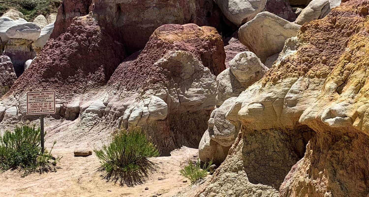
This next part of th trail takes you down right into the heart of the Paint Mines. After abou 0.6 miles, at the next trail junction, a spur trail goes to the left into the floor of the Paint Mines adding about 0.4 mile to the hike. Here is where you'll want to spend some time and snap some photos. Though the rock formations call out, be sure to stay the trail to protect this wild and fragile area and for your own safety.
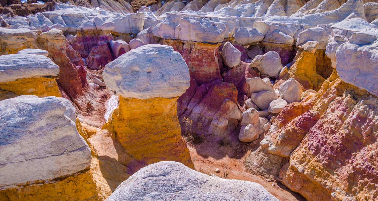
The Paint Mines were given their name because Native Americans used the crushed and colored sandstone to make paint and mined the soils to craft ceramic potter. Later, settlers mined the same area to make bricks. The swathes of color are made up of iron compounds that oxidize when the rock is exposed to air. Gypsum and quartize bring the white colors and sparkles to the rock. It's all clay, dense sandstone color, and the erosion from many years of water of wind has carved out some spectacular hoodoos (those columns of weird looking rock that stand out) and gullies that look like something from the surface of Mars.
To finish the hike, leave the gully floor and head North until the trail once again comes to the 4-way trail junction. Take a left and ascend about a half mile back to the trailhead.
Tips & Resources for Hiking The Calhan Paint Mines
- Fragile: The rock formations are made up a a brittle form of sandstone that easily chips and can be damaged even by the rubber soles of our shoes. Take care not to walk on the edges and near drop offs as the rock can give way. Do your part to care for the area by staying the trail.
- Photography: One of the best spots for taking photos of the paint mines is at the bench about 1.2 miles into the hike.
- Trail Map: Paint Mines
- Packing List: Always pack the 10 Essentials. Download our Hiking Guide to get the list and dayhiking packing checklist.
- Colorado Road Conditions: Colorado Road Conditions
- Photo: We would like to express our gratitude to Torrence Jackson for sharing such amazing photos with us of his family's hike at the Paint Mines. Along with Ryan Fonkert, Bryce Bradford, and Jay Gannet
- After the Hike: The Pikes Peak Brewing Company is situated in Monument, Colorado and a great spot to visit for a a drink and flatbread pizza.
Weather
Map & Driving Directions
Click for Driving Directions
Indian Creek Loop Hike
The Indian Creek Trail is tucked away outside of Sedalia, CO, just under an hour's drive from Denver, you find a trailhead leading to a vast internal system of trails that links up to the Colorado Trail, Roxborough State Park, and Nelson Ranch Open Space. The number of configurations you can devise awaits your creativity...and endurance! The Indian Creek Campground opens the door to trails meandering up and through the Pike National Forest with frequent vistas out into the valleys west and north. Explore the full Indian Creek Loop hike profile below for trail map, driving directions, and more tips and details to help you enjoy this adventure in the San Isabel National Forest.
Trail Snapshot: INDIAN CREEK LOOP
| Hike Distance | 7.5 miles Round Trip |
|---|---|
| Difficulty | Moderate |
| Duration | Approx 3-4hr |
| Trail Type | Loop |
| Starting Elevation | 7300′ |
| Elevation Gain | Approx +1300′ |
| Seasons | All Year |
| Dogs | Allowed On Leash |
| Hike Trail Map | Click for Trail Map of Indian Creek Loop |
| Denver Drive Time | 55 min |
| Driving Directions to Indian Creek Loop | Click for Google Map |
| Town Nearest Hike | Sedalia, Colorado |
| Beauty | Pine Forest, Streams, Colorado Trail |
| Activities | Hiking, Photography, Wildflowers |
| Fee | Entrance Fee or State Parks Pass Required for Roxborough State Park segment |
Parking & Trailhead Information for Indian Creek
The easiest waypoint for GPS is the Indian Creek Campground, which sits just west of the Rampart Range Riding Area on Highway 67. Once you pass the Rampart Range entrance the road curves and winds down a hill; at the bottom the parking lot appears off to the right with a lone bathroom. Park here; do not go up the road to the actual campground. The trailhead begins about 15 paces beyond the bathroom, up the hill. Look for the sign for Trail #800.
The Hike: Indian Creek Loop
The trail begins winding through aspen, oak, and evergreen. You'll immediately notice the clean, earthy air rising up from the forest floor. The initial stretch of the trail provides ample shade, and at approximately 0.5 mile, the trail opens up to its first vista. As the trail turns sharply right, the unofficial trail bends left up a small hill to a clearing with views down into the valley and a massive lean-to teepee tree.
Continuing up, soon another vista opens up off to the left with sight line down the valley and onto the next ridge line, and then at approximately 1.5 mile the trail reaches a junction with the fire road (FR) and Ringtail Trail. (If you follow Ringtail toward Thomas Hill, the trails opens up to th north. On a clear day you can see the skyscrapers of downtown Denver!) Staying straight to continue on the FR, the trail descends to approximately 2.3 mile to reach the next trail junction. Here you have options: take a sharp left to join Steven's Gulch Trail (the present track), veer right toward Roxborough State Park, or stay straight for a longer loop that will wrap back around to the present track. As the trail descends to the left, it reveals a snug little meadow swimming in prairie grasses--perfect playground for the deer often passing through.
Now, the hike becomes pure descent to approximately 4.25 mile and the junction with the Colorado Trail. (This is where the longer loop mentioned above rejoins the present track.) You know you're close when you spy an old broken down cabin nestled along the shore of the stream. Here, the loop route goes left onto the Colorado Trail.
All along the descent and this return ascent, thick foliage, flowers, ferns, and the occasional patch or puddle of mud keep you company. It's fascinating terrain that also hosts horse riders from time to time, so watch your step! At 5.0 mile the Colorado Trail continues straight but an alternate Indian Creek Trail pulls sharply right. Staying straight on the Colorado Trail the trail begins another descent.
While this loop hike follows a stream almost all the way, you get the pleasure of a stream crossing at approximately 6.25 mile when it meets up with Bear Creek. From here the trail bends its way up and out of the shallow canyon, past the equestrian stables and campground, and back to the parking lot.
Tips & Resources for Hiking Indian Creek Loop
- TIP: Wildlife is active in this area. Be sure to let someone know your hiking itinerary, or take a hiking partner with you.
- TIP: Familiarize yourself with the various trail junctions that intersect in this area. You can trek to Roxborough, connect to the Colorado Trail, or end up in an open space...on accident if you're not aware! Also, keep an eye on the weather as it can change suddenly along the Front Range.
- Trail Map: Indian Creek Loop
- Packing List: Always pack the 10 Essentials. Download our Hiking Guide to get the list and dayhiking packing checklist.
- Colorado Road Conditions: Colorado Road Conditions
- After the Hike: If you need breakfast, hit up the local fave, O'Brien's Cafe, or catch a pizza-pie at PieZano's
Weather
Map & Driving Directions
Click for Driving Directions
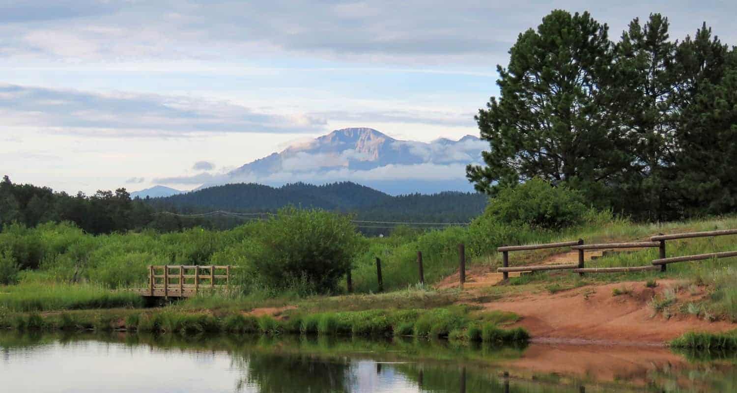
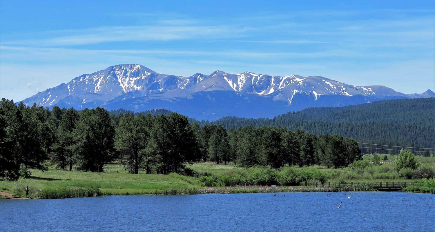
Manitou Lake Hike Near Colorado Springs
Manitou Lake near Colorado Springs offers a pleasant and easy loop trail around its shores with views of Pikes Peak. It's also a great spot fishing and paddling on the 5-acres of water. There are nearby camping options detailed below. Explore the full Manitou Lake hike profile below for trail map, driving directions, campground info and more.
Trail Snapshot: Manitou Lake Loop Hike
| Hike Distance | Approx. 1 mile Round Trip |
|---|---|
| Difficulty | Easy |
| Duration | approx. 1 hour |
| Trail Type | Loop |
| Starting Elevation | 7,700′ |
| Elevation Gain | Nominal |
| Seasons | Year Round |
| Dogs | Allowed On Leash; Not allowed in Water |
| Hike Trail Map | Click for Trail Map of Manitou Lake Loop Hike Map |
| Denver Drive Time | 1hr 45min |
| Driving Directions to Manitou Lake | Click for Google Map |
| Town Nearest Hike | Woodland Park, Colorado |
| Beauty | Views of Pikes Peak, |
| Activities | Hiking, Paddleboarding, Canoeing and Kayaking, 2 nearby campgrounds, birdwatching, and fishing. Swimming is prohibited. |
| Fee | $7 day use fee per vehicle |
Parking & Trailhead Information for Manitou Lake
Interstate Route
From Denver, take Interstate 25 South to Colorado Springs. Exit onto 24 West and drive US Highway 24 about 18 to Woodland Park. In Woodland Park, take HWY 67 North for about 7.5 miles. Manitou Lake will be on the east side of the highway.
Scenic Route
The scenic route and interstate route take about the same amount of time, but there will likely be less traffic on this trip. There are a lot of curves though, so be prepared for that aspect of the drive. From Denver, take 285 South toward Pine Junction. Take a left onto Pine Valley Road, which curves around through some beautiful Front Range landscapes, goes through Pine and just outside of Buffalo Creek the road changes names to Deckers Road. Follow Deckers road until it terminates at US 67 in Deckers. In Deckers, take US 67 South (right) for 15.7 miles. Manitou Lake will will be on the lefthand (east) side of the road.
Trailhead and Facilities
Manitou Lake is heavily used in the Summer months and weekends and has limited parking. There are two vault toilet, one across from the pavillion and one adjacent to the parking loop area. The pavillion can be reserved for a fee from Recreation.gov site. It's important to note when reserving that each vehicle is still required to pay the day use access fee. There are several access trails that run from the parking area to the main trail that circles the lake.
The Hike: Manitou Lake
Beginning at the access trail near the pavillion, head toward the lake to pick up the main trail near a small dock. Head north (left) hiking along the western shore of the lake. You'll pass another small fishing dock, then come to a trail intersection. Go right, crossing the small footbridge spanning Trout Creek, the small creek that feeds the reservoir.
Continue following the trail along the northern edge of Manitou Lake as it eventually bends toward the south. Here, you'll be able to take in the best views of Pikes Peak. This is why we recommend hiking the loop clockwise instead of counter clockwise. Stop to take in Summer wildflowers that grow in the meadows surrounding the lake.
The trail will then enter and exit a small stand of ponderosa pines. Then the trail bends to the west and crosses a marshland. Be alert for herons and other wildlife in this wetland segment of the trail. The dirt path becomes a boardwalk on this final segment of the trail.
Longer Hike Options
There are ways to extend your hike and explore other areas around Manitou Lake. The first is a trail segment north of the lake, near the bridge that leads along Trout Creek. This is an undeveloped social trail created by fisherman, so it's a non-destination trail and has a lot of small spurs to access the creek. The second trail leads South to the Colorado Campground site. The third is the 4.2 mile segment of bike trail that runs alongside highway 67 connecting the campgrounds and Manitou Lake.
Camping Near Manitou Lake
There are several campgrounds along highway 67 near Manitou Lake to serve the Pikes Peak Region. Here's a list from the southern end to the north with links to their reservation pages. All of these campsites are close to Woodland Park andn great places to basecamp for exploring the surrounding Colorado Springs area. All have toilets and water.
- South Meadows Campground: Open June through Oct. 27 (see page for updated dates), access to bike path and forest roads. Shaded by ponderosa pines. About 60 total campsites.Reserve South Meadows camping sites online at recreation.gov
- Pike Community Campground: Open each year May 22 through Sept. 8 (see page for updated dates), a single group site that can accomodate up to 100 people. Closed in 2020 due to COVID-19 restrictions. Reserve South Meadows camping sites online at recreation.gov
- Colorado Campground: Open June through Sept. 7 (see page for updated dates). Both single family and double-family campsites. About 80 campsites. Access to Manitou Lake, shaded by ponderosa pines. Reserve South Meadows camping sites online at recreation.gov
- Painted Rocks Campground: Open June through Sept. 7 (see page for updated dates). About 18 campsites. Named for nearby sandstone rock formations. Reserve South Meadows camping sites online at recreation.gov
Tips & Resources for Hiking Manitou Lake
- Fishing: The Department of Wildlife stocks Manitou lake with Rainbow and Cutbow Trout. The beaver ponds above lake along Trout Creek are also good spots to fish.
- Dogs at Manitou Lake: Manitou Lake is a great spot to take your dog for a walk. Because it is a reservoir, dogs must be kept out of the water and leashed at all times.
- Trail Map: Manitou Lake
- Packing List: Always pack the 10 Essentials. Download our Hiking Guide to get the list and dayhiking packing checklist.
- Colorado Road Conditions: Colorado Road Conditions
- Photo: We would like to express our gratitude to Patricia Henschen for sharing such an amazing photograph of this hike at Manitou Lake near Colorado Springs.
- After the Hike: The Donut Mill. The Donut Mill serves epic donuts. That's not an overstatement. The donuts are gigantic and dream-inducing (perhaps from the sugar coma). They cost more than most donut places, but if you are a donut lover, this place is not to be missed. Their biscuits and gravey also are a worth noting.
Weather
Map & Driving Directions
Click for Driving Directions
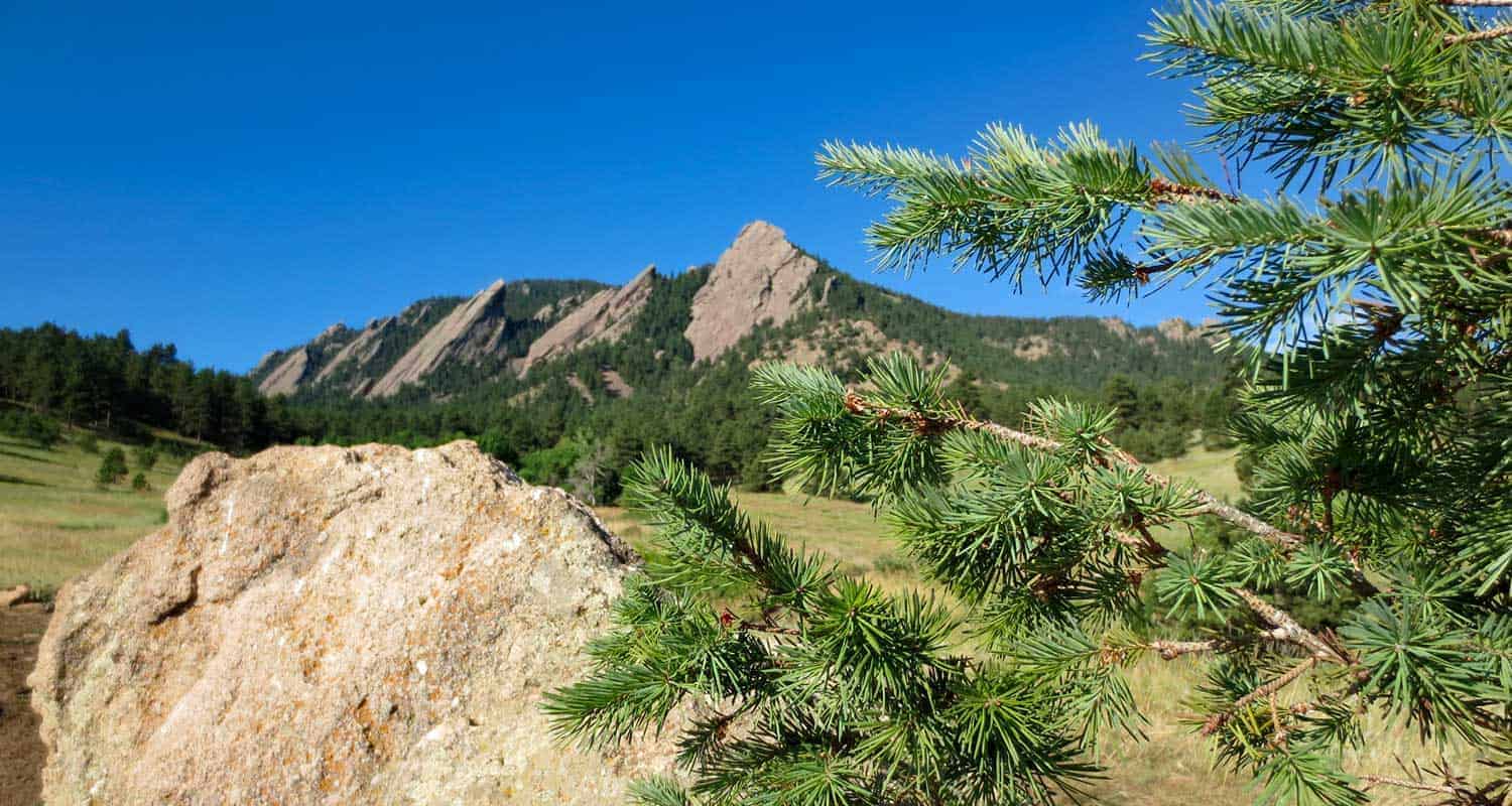
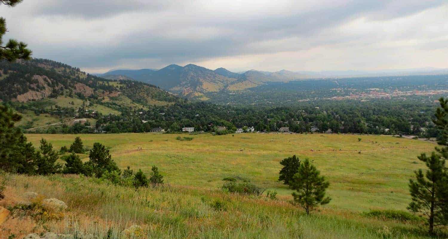
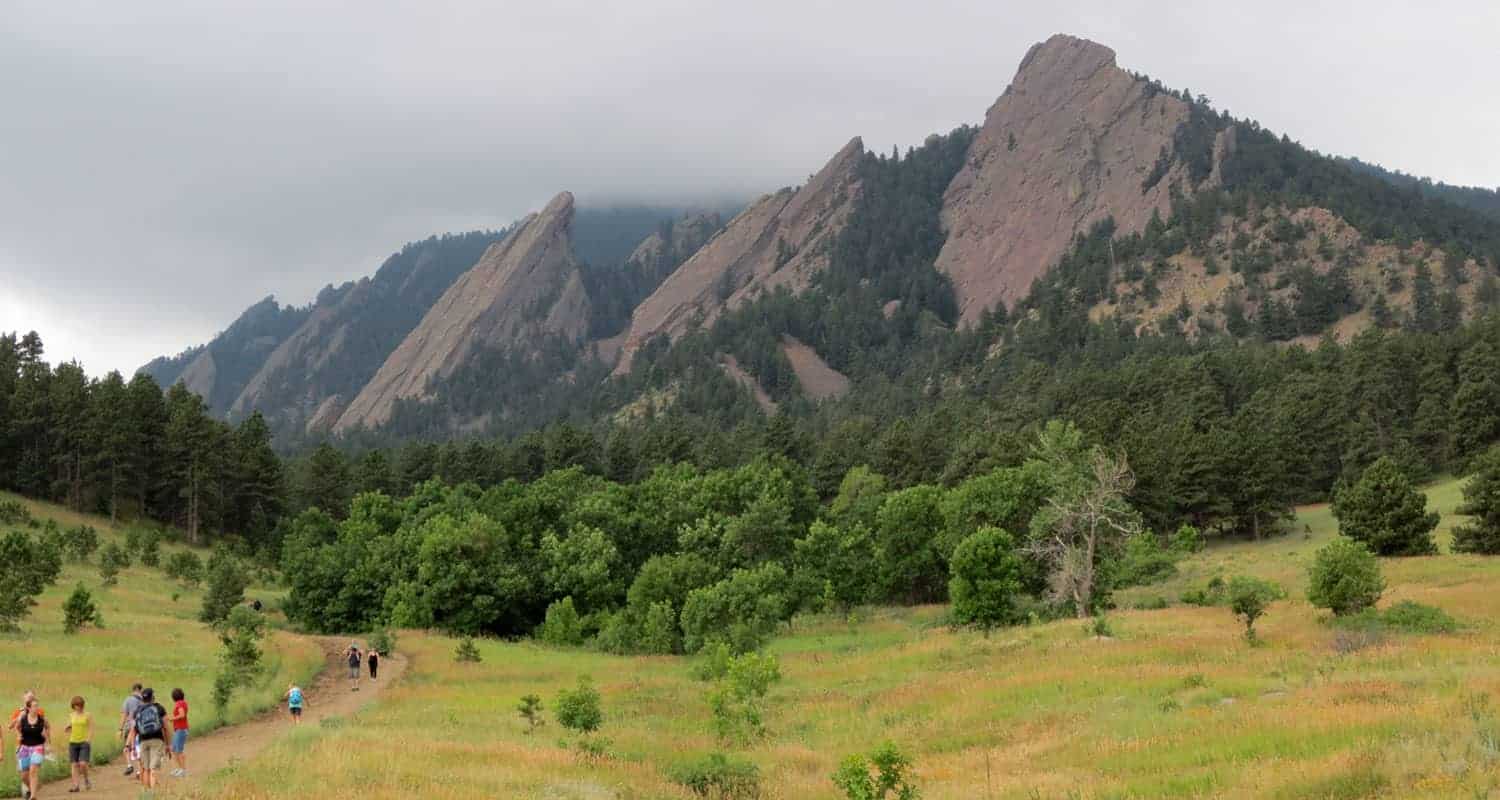
Chautauqua Loop Trail in Boulder
The Chautauqua Trail is an easy 3.6 mile loop hike along Boulder's Flatirons. The trails pass several historical sites: a quarry, cabin, shelter, and ski area as it weaves through the meadows and ponderosa forest of Chautauqua Park. About 40 minutes from Denver, the Chautauqua Loop hike makes for a great hike for visitors who are looking for stunning landscapes without the long drive or elevation gain.
Trail Snapshot: Chautauqua Loop Hike
| Hike Distance | 3.6 Miles |
|---|---|
| Difficulty | Easy |
| Duration | 2 hrs |
| Trail Type | Loop |
| Elevation Gain | Approx +700′ |
| Seasons | All Year |
| Dogs | Allowed on Leash |
| Hike Trail Map | Click for a Trail Map for the Chautauqua Loop |
| Denver Drive Time | 40 min |
| Directions | Click for Google Map |
| Town Nearest Hike | Boulder, Colorado |
| Beauty | Rock formations, ranger cottage, raptors, quarry site, Roosa Cabin, Bluebell Shelter |
| Activities | Hiking, Picnics, Wildlife |
Parking & Trailhead Information for the Chautauqua Loop
The trailhead for Chautauqua Park is located downtown in the City of Boulder. The park's 58 parking spaces fill quickly, so plan to arrive early. Alternatively, when the lot is full, hikers can park along Baseline Road and side streets, just be sure to respect the neighbors by parking at least 5 feet from driveways. There are bike racks at the trailhead, so you can bike in from other lots in town, or take the Park-to-Park Shuttle that operates on the weekends and on holidays from the Saturday around Memorial Day to Labor Day Weekend. Here's a map of the free parking lots and shuttle stop locations.
Get a map, fill up your water bottle, and get trail advice from locals at the Ranger Cottage, which is located at the trailhead. See the Ranger Cottage site for current hours and closure information.
The Hike: Chautauqua Loop
Beginning at the Ranger Cottage, head south on the Bluebell Road Trail. This first segment leads up a gentle slope to its intersection with the Mesa trail. The Mesa trail takes us into our first lollipop loop and to Woods Quarry. After about 0.2 of a mile, you'll come to another trail intersection. Heading right, takes you on a counter-clockwise loop and up to Woods Quarry. The quarry was used in the early years of Boulder for building homes and sidewalks out of its iconic red and orange sandstone.
After the quarry, the trail will bend north and return to the Mesa Trail. At the intersection, notice an old stone structures, the Roosa Cabin.
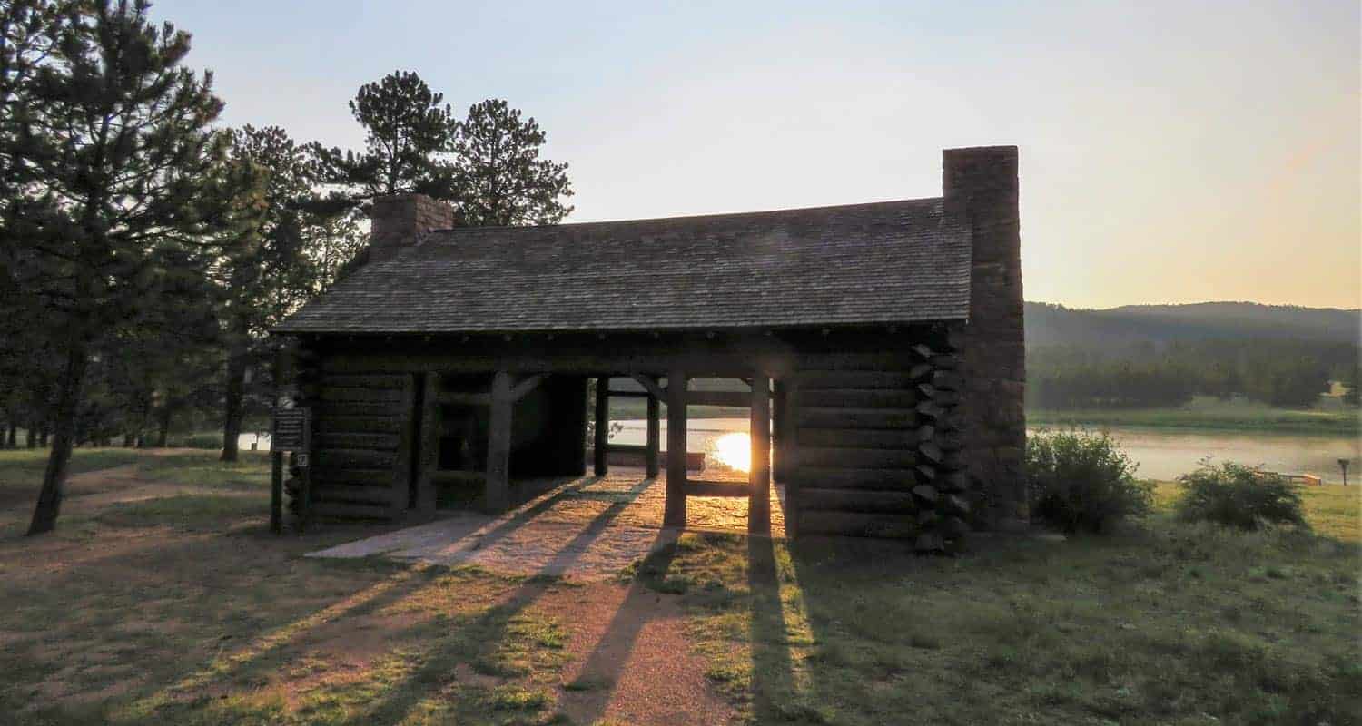
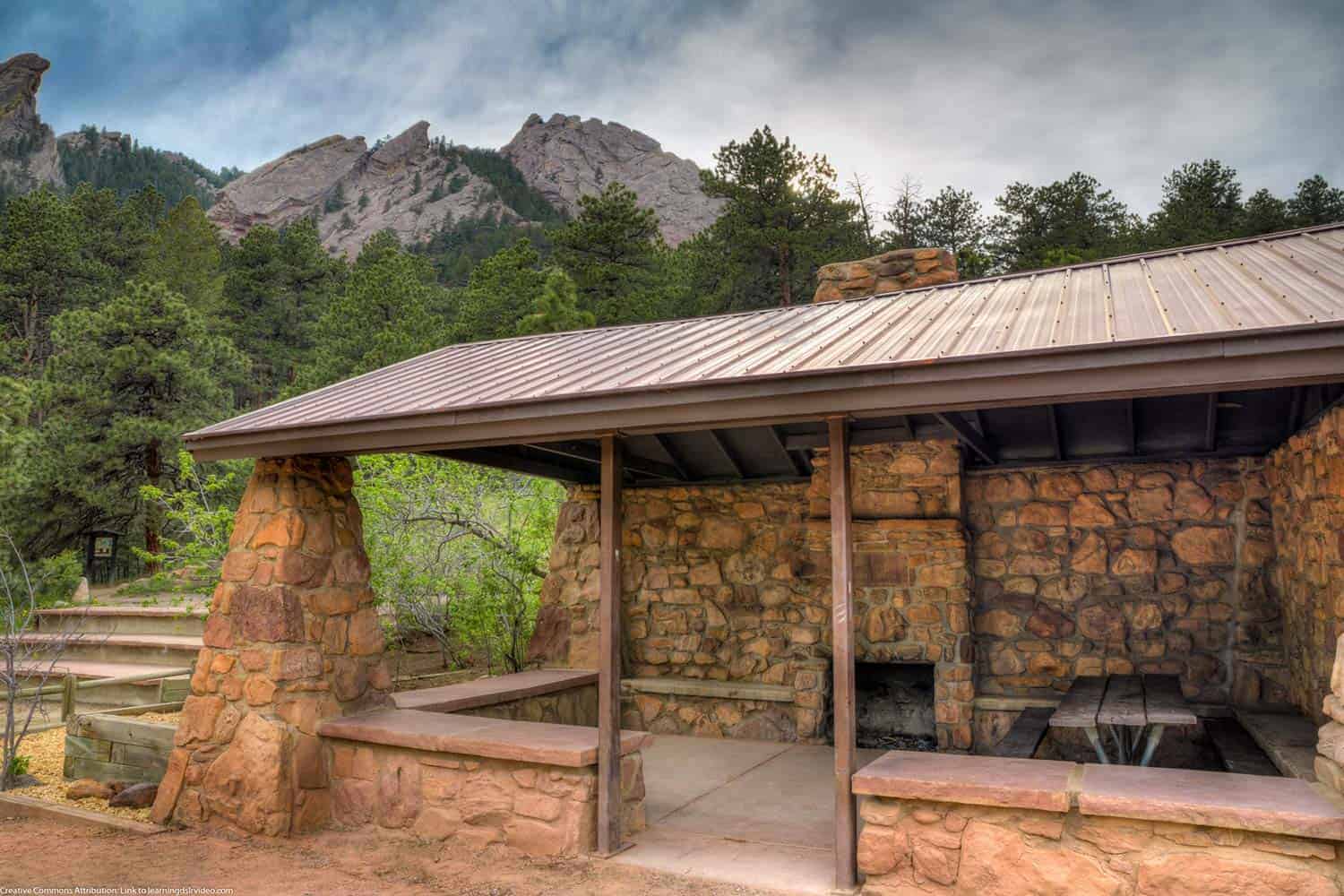
Continue north on the Mesa Trail back up to the Bluebell Road Trail. Go west (left) onto Bluebell Road. Soon you'll encounter another stone structure, the Bluebell Shelter (pictured below). Built in the early 1900's and preserved in the 1930's by the CCC, the historic shelter has become a Chautauqua landmark, undergoing some more recent restoration. This is a great place to have a picnic, and can be reserved for special events.
Now we begin heading into the northern and larger loop of this hike. The Bluebell Road Trail becomes the Bluebell-Baird trail and weaves its way north along the base of the Flatirons. If you are interested in hiking the Flatirons, explor our trail profile for the First and Second Flatirons Hike. You'll enter tall stands of Ponderosa pines with views out to the meadows of the northern meadows.
Notice the interpretive signs along the full hike and stop to read the history of the old ski jump that was in operation post WW2 into the early 1960's. Pass by the Ski Jump Trail and continue northwest until you come to the Gregory Canyon Trailhead. Gregory Canyon is also a beautiful hike (see our Gregory Canyon trail profile for details). Take a right (heading east) onto the Baseline Trail. This will take you past the old ski jump and the site of a CCC camp that operated here during the years of the Great Depression.
The Baseline trail will lead back to the trailhead to complete this 3.6 mile hike.
Tips & Resources for Hiking the Chautauqua Loop
- Bring Snacks and Water: It probably goes without saying, but be sure to bring food and water to refill your tank. This hike demands it.
- Bring Your Camera: This area along the Flatirions is picturesque, especially in the early morning light.
- Keep and Eye on the Weather: Talking to one of the rangers, he shared that storms can come up quickly along the Flatirons, which will catch hikers unawares. The Flatirons area is like a lot of other mountain hikes, storms typically roll in during the early afternoon.
- Trail Map for Chautauqua Loop: Trail Map Link
- Colorado Road Conditions: Colorado Road Conditions
- Photo: We would like to express our gratitude to Dave Dugdale for sharing his photograph of the Bluebell Shelter.
- After the Hike: Ozo Coffee in Boulder, Colorado

Weather
Map & Driving Directions
Click for Driving Directions

Fallen Timbers Loop Hike at Fox Run Park
The Fallen Timbers Loop is an easy, 2-mile hike near Colorado Springs with great views of Pikes Peak. It makes for a great family hike because of the shade of the ponderosa pines and the nearby playground at this hike in Fox Run Regional Park. Explore the full hike profile for trail map, driving directions, and tips.
Trail Snapshot: Fallen Timbers Loop Hike
| Hike Distance | 2 Miles |
|---|---|
| Difficulty | Easy |
| Duration | Approx 1 hour |
| Trail Type | Loop |
| Starting Elevation | 7300′ |
| Elevation Gain | Approx +200′ |
| Seasons | Year Round |
| Dogs | Allowed On Leash |
| Hike Trail Map | Click for a Map of Fallen Timbers Loop at Fox Run Regional Park |
| Denver Drive Time | 1 hr 15 min |
| Driving Directions to Fox Run Regional park | Click for Google Map |
| Town Nearest Hike | Monument, Colorado |
| Beauty | Ponderosa pine forest, ponds, and views of Pikes Peak. |
| Activities: | Hiking and mountain biking trails, Dog Park, Playground with climbing rock, gazebo. |
Parking & Trailhead Information for Fallen Timbers Loop at Fox Run
From Denver, take interstate 25 South and take exit 158 onto Baptist Road (left). Drive East for 2.3 miles and turn right onto Tari Drive. Proceed for about 300 feet, then take a left onto Becky Drive. Go about 1/2 mile and turn left onto Stella Drive. Drive about another 1/2 mile and the entrance to Fox Run park will be on your left. Drive around the loop to the parking area by the pond. This trailhead parking area has a restroom just to the southwest of the parking lot.
The Hike: Fallen Timbers Loop
The trail for the Fallen Timbers loop hike begins on the northeast end of the parking lot. When facing the pond, this will be the wide trail behind you, across the drive, and to the left. This little connector trail will soon come to a junction with the loop trail. I recommend hiking this counter-clockwise, so take a right onto the Fallen Timbers trail to begin the loop.
The trail works its way through the dappled shade of ponderosa pines and bends to the right (east). You'll encounter a couple trail junctions. At the junctions, stay on the Fallen Timbers trail (bearing right). Just shy of 1 mile into the trail, you'll arrive at the Roller Coaster Road parking area for Fox Run. The trail will continue north past this trailhead. However, there is a restsroom here at the trailhead that is open April through October.
The trail continues north, crossing a footbridge, then begins to bend West (left). Orange blaze markers should mark out the trail.
Along this entire trail, you'll find interpretive signs explaining the impact of the pine beetle and tree bores on the ecosystems of Colorado, and about the local fauna in this area north of Colorado Springs. This makes for a great discussions with the kids about the environment and the impact that even small creatures and lightning can have on forests.
The trail bends South, opening up to great views of Pikes Peak. You'll pass a small trail junction that leads right (west) out to the road. Continue past this and eventually you'll come to a decision to either go left (east) finish this 2-mile loop or bear right and extend your hike to make it a longer 2.5 to 3 mile hike. Consult the Fox Run Trail Map, and follow the wester and southern trails of your choice. However, this profile will follow the rest of the 2-mile loop.
Going right will lead into a central parking area. The trail goes east, cutting through the middle of this circle road and then splits. At the split, take a right to begin the approx. 1/4 mile segment back to the parking area and trailhead.
Tips & Resources for Hiking the Fallen Timbers Loop
- A Great Wedding Spot: I've attended two weddings at Fox Run. It's a beautiful and inexpensive option to host a wedding at the Wedding Gazebo. The gazebo can be reserved through the El Paso County reservation site.
- Taking Photos: The best time to get a photo of Pikes Peak will be in the early morning hours as the sun is rising over the plains. Photographers can capture some dramatic shots of the mountain as its skirts will still be in darkness and the peak bathed in soft light.
- Easy but Elevation: This is an easy hike, but if you are traveling to Colorado Springs from lower elevations, the 7300' starting elevation at Fox Run park may make this trail a challenge. if that's the case, take your time and oxygenate by drinking plenty of water.
- Trail Map: Trail Map for Fox Run Park
- Packing List: Always pack the 10 Essentials. Download our Hiking Guide to get the list and dayhiking packing checklist.
- Colorado Road Conditions: Colorado Road Conditions
- Photo: We would like to express our gratitude to Dave Jacquin , Mariana Wagner , and Nate Zoch for sharing such an amazing photographs of this hike to at Ute Valley Park.
- After the Hike: Serranos Coffee in Monument
Weather
Map & Driving Directions
Click for Driving Directions
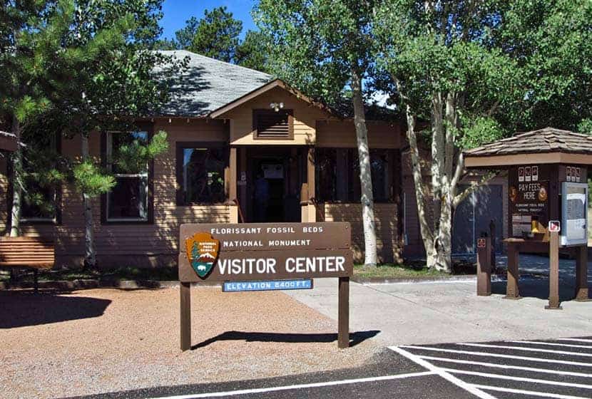
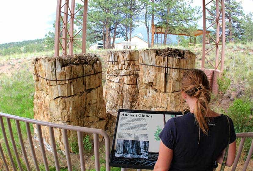
Petrified Forest Hike at Florissant Fossil Beds
The Petrified Forest trail is an easy 1.5 mile loop hike just a 50 minute drive from Colorado Springs. This hike at the Florissant Fossil Beds National Monument takes you past the fossilized stumps of ancient sequoia trees, over rolling mountain meadows with views of snowcapped peaks, and is a great way to learn about the geology of Colorado while enjoying nature with your family. Explore the full Petrified Forest hike profile below for trail map, driving directions, and more tips and details to help you enjoy this hike near Colorado Springs.
Trail Snapshot: Petrified Forest Loop at Florissant Fossil Beds
| Hike Distance | 1 to 1.5 miles Round Trip |
|---|---|
| Difficulty | Easy |
| Duration | Approx 1hr |
| Trail Type | Loop |
| Starting Elevation | 8200′ |
| Elevation Gain | Approx +100′ |
| Seasons | Year Round |
| Dogs | Pets are not allowed on the trails |
| Hike Trail Map | Click for a Map of Hiking Trails Map at Florissant Fossil Beds |
| Denver Drive Time | 2 hours |
| Driving Directions to Florissant Fossil Beds | Click for Google Map |
| Town Nearest Hike | Florissant, Colorado |
| Beauty | Petrified stumps of ancient sequoia trees, high plains meadows, early homestead ranch, pine and aspen woods, shale outcrop ,and other geological areas of interest |
| Activities | Hiking, photography, fossil displays, interpretive signs and outdoor exhibits, Junior Ranger activity, Shadows of the Past movie at the Visitor Center, and guided Ranger-led programs. |
| Fee: | A Day Pass Fee is Required for this Site. We recommend getting the America the Beautiful pass each year. |
Parking & Trailhead Information for Florissant Fossil Beds National Monument
The Scenic Drive Option
The scenic drive from Denver to Florissant Fossil Beds is only about 10-15 minutes longer, and with the construction on interstate 25 between Castle Rock and Monument (2019-2022). Here's a link to driving directions for the scenic route through Deckers and West Creek to Woodland Park. This route takes 285 toward Pine, then picks up CO67 for a windy, but beautiful drive through Pike National Forest lands. In Woodland Park, take a right onto US-24 West. Go about 8.4 miles then turn left onto Twin Rocks Road. Drive about 5.8 miles to Teller County Rd 1. Take a right onto Teller County Rd 1, then after about 0.8 mile, take a left into the entrance of the Florissant Fossil Beds National Monument.
Directions Via Interstate 25
Take Interstate 25 South to Colorado Springs where you'll exit on exit 141 onto US-24/West Cimarron St. Head West on 24 into the canyon that winds up to Woodland Park. In Woodland Park, stay on US-24 West. After passing the Dinosaur Museum in Woodland Park, you'll drive about 5.8 miles then turn left onto Twin Rocks Road. Drive about 7 miles to Teller County Rd 1. Take a right onto Teller County Rd 1, then after about 0.8 mile, take a left into the entrance of the Florissant Fossil Beds National Monument.
Visitor Center and Trailhead
Florissant Fossil Beds is a National Monument and managed by the National Parks office. Like all Federal Recreation sites, entrance to the monument requires a fee. We get an America the Beautiful Pass every year, giving our family access to more than 2000 federal recreation sites, including Florissant Fossil beds. There are restrooms at the visitor center, as well as an interpretive center. Feb. 1 through Nov. 9th, the visitor center and trails are open from 9AM-5PM, and Winter hours are 9AM-4:30PM. It's Closed during New Years, Thanksgiving, and Christmas days.
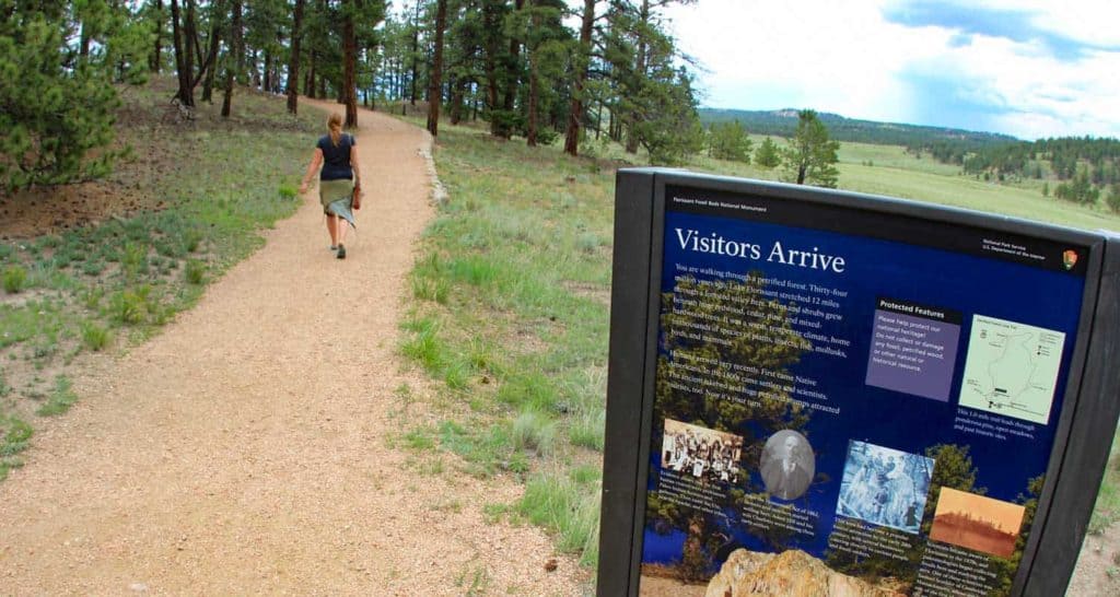
The Hike: Petrified Forest Hike
There are two short loop trails that you can hike from the visitor center. The first is the 1-mile Petrified Forest Loop, and the second is the 1/2 mile Ponderosa Loop. We recommend combining the two loops to make a 1.5-mile hike.
Petrified Forest Loop
This trail is the centerpiece of the national monument. Start by picking up a guide at the visitor center and first checking out the covered exhibits directly behind the visitor center. The guide will have explanations of the different sites marked by a series of numbered posts along the trail. The Petrified Forest Loop can be hiked in any direction. The trail leads into the ancient bed of Florissant Lake, an area rich in silica that settled in layers to fossilize plants and insects throughout this area.
Along the trail, you'll pass through open meadow and wooded areas. Fences mark protected stumps of the giant petrified trees that once dominated this high plains environment. Geologists believe volcanic eruptions triggered mudslides that covered the prehistoric forest floor. That mud was rich in silica-based minerals that soaked the wood, eventually replacing its organic material and fossilizing it.
Eventually, the trail will take you to the Big Stump, the largest of the petrified trees not removed by early collectors. When here, take your phone out and turn on the ruler tool. Mark the base of the tree, then extend your phone into the air until it marks 250 feet. That will give you an idea of the size of these trees.
The Ponderosa Loop
After the Petrified Forest Loop, head into the shade of the Ponderosa Loop. This easy, 1/2-mile trail is wheelchair accessible and made of packed, crushed gravel. This loop trail is located in the trees south of the Stump Shelter and Amphitheater. Keep your eyes peeled for Abert's Squirrels, large black squirrels that have long, pointed and tufted ears. From this trail, you can also pick up the Sawmill Trail that loops around the southwest area of the park.

Tips & Resources for Hiking the Petrified Forest at Florissant
- An Educational Experience: The Florissant Fossil Beds are a great place to take your family to learn about the geology of Colorado. The National Monument page provides a Hike Activities lesson plan for educators.
- Stargazing: During most months, the park offers stargazing opportunities through their Night Sky Programs. It starts with a short ranger-led talk then turns to 90-minutes of enjoying the stars through the lens of telescopes with volunteers from the Colorado Springs Astronomical Society.
- Trail Map: Florissant Fossil Beds Hiking Trail Map
- Packing List: Always pack the 10 Essentials. Download our Hiking Guide to get the list and dayhiking packing checklist.
- Colorado Road Conditions: Colorado Road Conditions
- Photo: We would like to express our gratitude to Patricia Henschen , David Fulmer , and Jasperdo for sharing such an amazing photographs of this hike to at Ute Valley Park.
- After the Hike: Iron Tree Table and Taps in Florissant
Weather
Map & Driving Directions
Click for Driving Directions
Ute Valley Park Loop in Colorado Springs
Ute Valley Park offers an easy 3-mile loop hike in the heart of northern Colorado Springs with views to snow-capped Pikes Peak. The trails make for a quick break from the city to trail run or walk the dog. Get the trail details, map, and driving directions in our full trail profile.
Trail Snapshot: Ute Valley Park
| Hike Distance | 2.5 to 3 miles Round Trip |
|---|---|
| Difficulty | Easy |
| Duration | Approx. 1.5 |
| Trail Type | Loop |
| Starting Elevation | 6550′ |
| Elevation Gain | Approx +200′ |
| Seasons | Year Round |
| Dogs | Allowed On Leash |
| Hike Trail Map | Click for a Map of Ute Valley Park Trails |
| Denver Drive Time | 1 hr 15 min |
| Driving Directions to Ute Valley Park | Click for Google Map |
| Town Nearest Hike | Colorado Springs, Colorado |
| Beauty | Views of Pikes Peak, Pope Bluffs formation, Juniper and Ponderosa Pine, Desert Wildflowers |
| Activities | Hiking and Mountain Biking |
Parking & Trailhead Information for Ute Valley Park
From Denver, take Interstate 25 South to Colorado Springs, exiting on exit 149 and taking a right onto East Woodman Road. East Woodman will turn into Rockrimmon Road. Next, take a right onto Vindicator Drive. The entrance to Ute Valley Park will be up on your left, just after you pass the Middle School. There is a portable toilet at the trailhead and parking for about 20 vehicles.
The Hike: Ute Valley Park
Ute Valley Park is nestled in the subdivisions of Colorado Springs, North of the city center providing residents with a quick escape from town for an after work trail run, mountain bike, and place to walk the dog. There are about 20 different unnamed trail segments, but for our purposes, we will look at a 3 mile loop and a shorter 2.5 mile option.
From the trailhead, take the trail that heads south out of the lot and hike west towards the bluffs. This approach will take us on a counterclockwise loop hike of the trails. Alternatively, you can hike it counterclockwise by reversing this description. Ignore the other trails at the juncture and keep and heading south, the trail will gradually rise to gain the low ridge of Popes Bluff. Along this stretch you'll soak in the sunshine and views out to Pikes Peak.
This stretch of trail is the longest and goes for about a mile to an overlook at the southwest end of Ute Valley Park. You'll pass through one trail intersection before you come to that overlook point. However, if you want to cut off 1/2 a mile and make this a 2.5 mile loop, take a left at that juncture for a more rugged trail that cuts over to the east side of the park and reconnects with this loop. Though in the city, you'll be taking in the aromatics of ponderosa pine and the same juniper trees that are found along the trails in Garden of the Gods.
Continuing with our 3-mile loop description, at the overlook, you have a couple options, but we'll go straight through on the trail that wraps around the most southern end of Ute Valley. See the Ute Valley Park Trail Map for detail.
After about 0.4 of a mile, the trail will begin turning North, traveling along the eastern edge of the park. You'll encounter about 5-6 trail junctures along this stretch. At each juncture, continue on the easternmost trail (keep bearing to the right, or hike straight through). You'll cross over a footbridge and after approximately another another 1/2 mile will be back at the parking lot.
Tips & Resources for Hiking Ute Valley Park
- TIP: Sunscreen is a must as most of the trail is exposed to the sun.
- Trail Map: Ute Valley Park Map
- Packing List: Always pack the 10 Essentials. Download our Hiking Guide to get the list and dayhiking packing checklist.
- Colorado Road Conditions: Colorado Road Conditions
- Photo: We would like to express our gratitude to Patricia Henschen , Tim Marshall , and Rob Lucas for sharing such an amazing photographs of this hike to at Ute Valley Park.
- After the Hike: Kairons Coffeehouse for Coffee and Lunch
Weather
Map & Driving Directions
Click for Driving Directions